Hi, Welcome to my Rattlesnake Ridge photo journal adventure! Feel free to take a peak at images below and also find links to videos that I have uploaded to my YouTube channel.
If you are interested in helping my channel, you can do so by donating by clicking HERE you can donate anonymously and without having a Paypal account.
If you are interested in helping my channel, you can do so by donating by clicking HERE you can donate anonymously and without having a Paypal account.
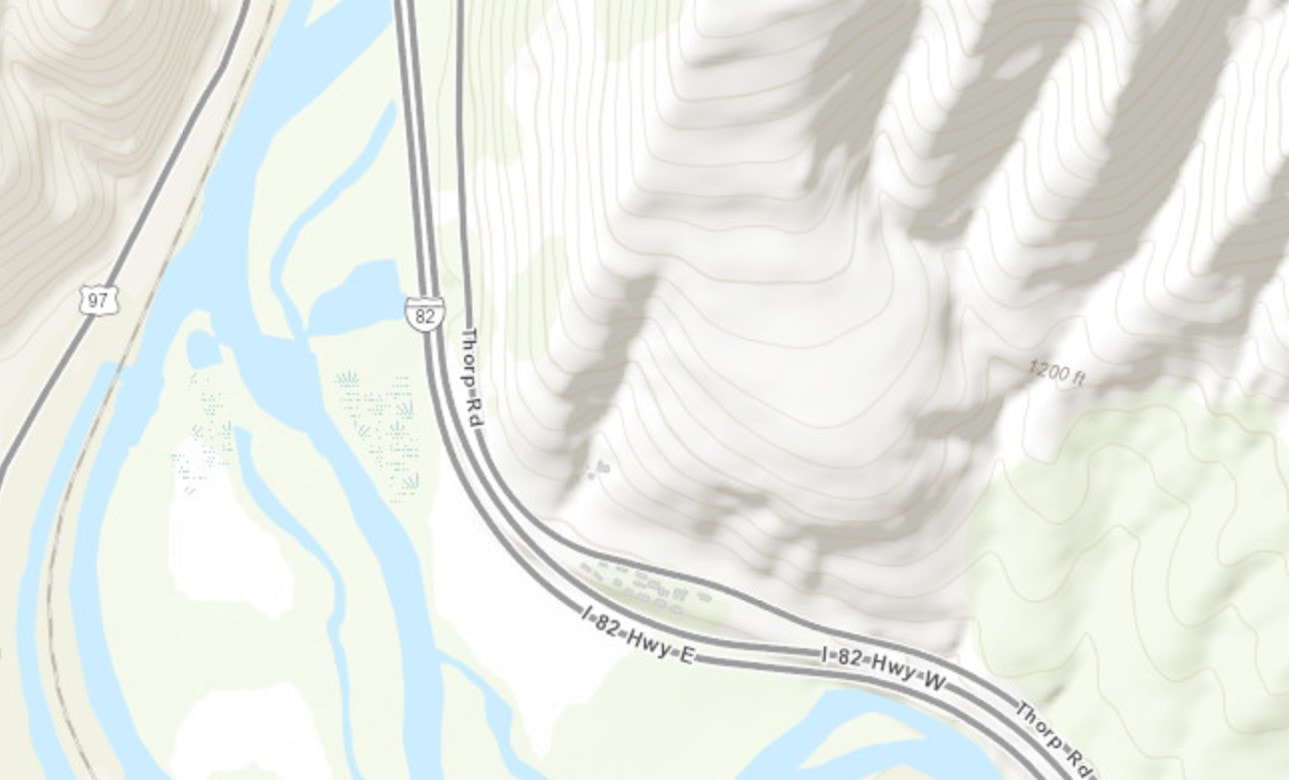
Google Earth
If you are interested in helping my channel, you can do so by donating by clicking HERE you can donate anonymously and without having a Paypal account or you can also send me Fan Mail at
EZ C Productions
P.O Box 641
Zillah, WA 98953
I will do an unboxing video and a grand shout out!
Love yous!
EZ C Productions
P.O Box 641
Zillah, WA 98953
I will do an unboxing video and a grand shout out!
Love yous!
Compiled Images Video
Videos Newest to Oldest
Newest videos posted on Youtube are listed first then in chronological order of events and posts.
Newest Post! Xoxo
Here is a link to see the Live Cam at the RR
http://www.alertwildfire.org/oregon/
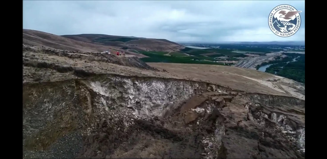
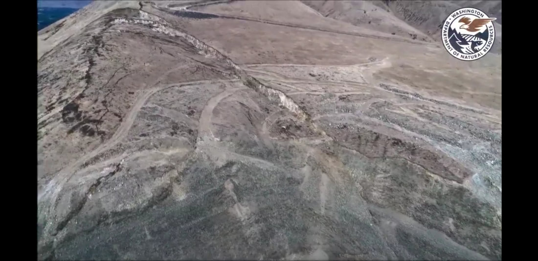
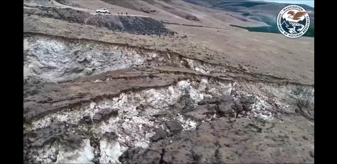
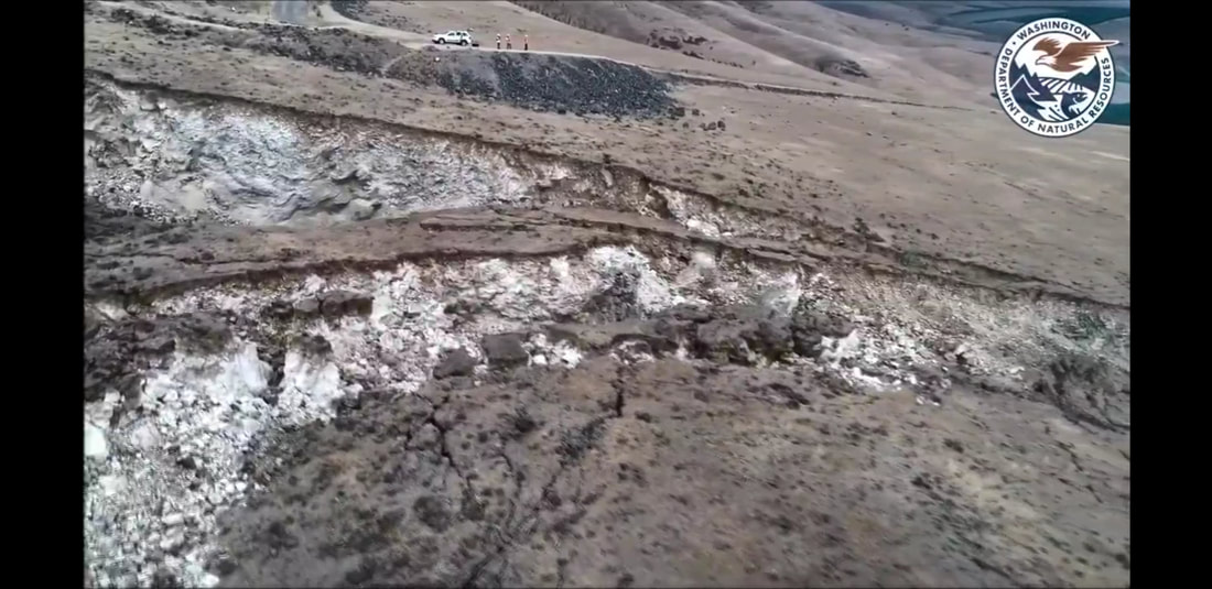
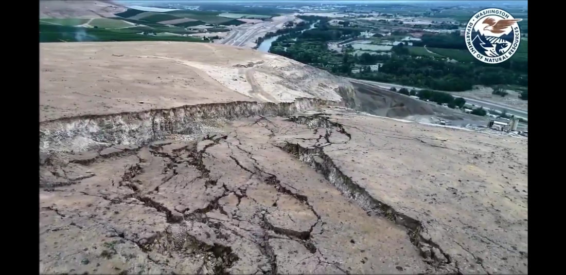
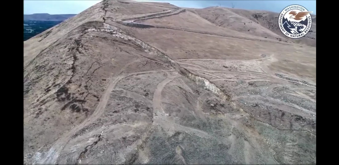
Aerial images from rattlesnake ridge Near Yakima
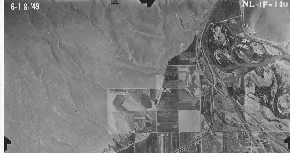
Aerial View of Rattlesnake Ridge near Yakima, Top Right Corner.
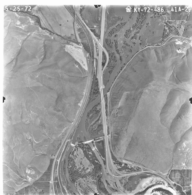
Aerial image of RR 1972.
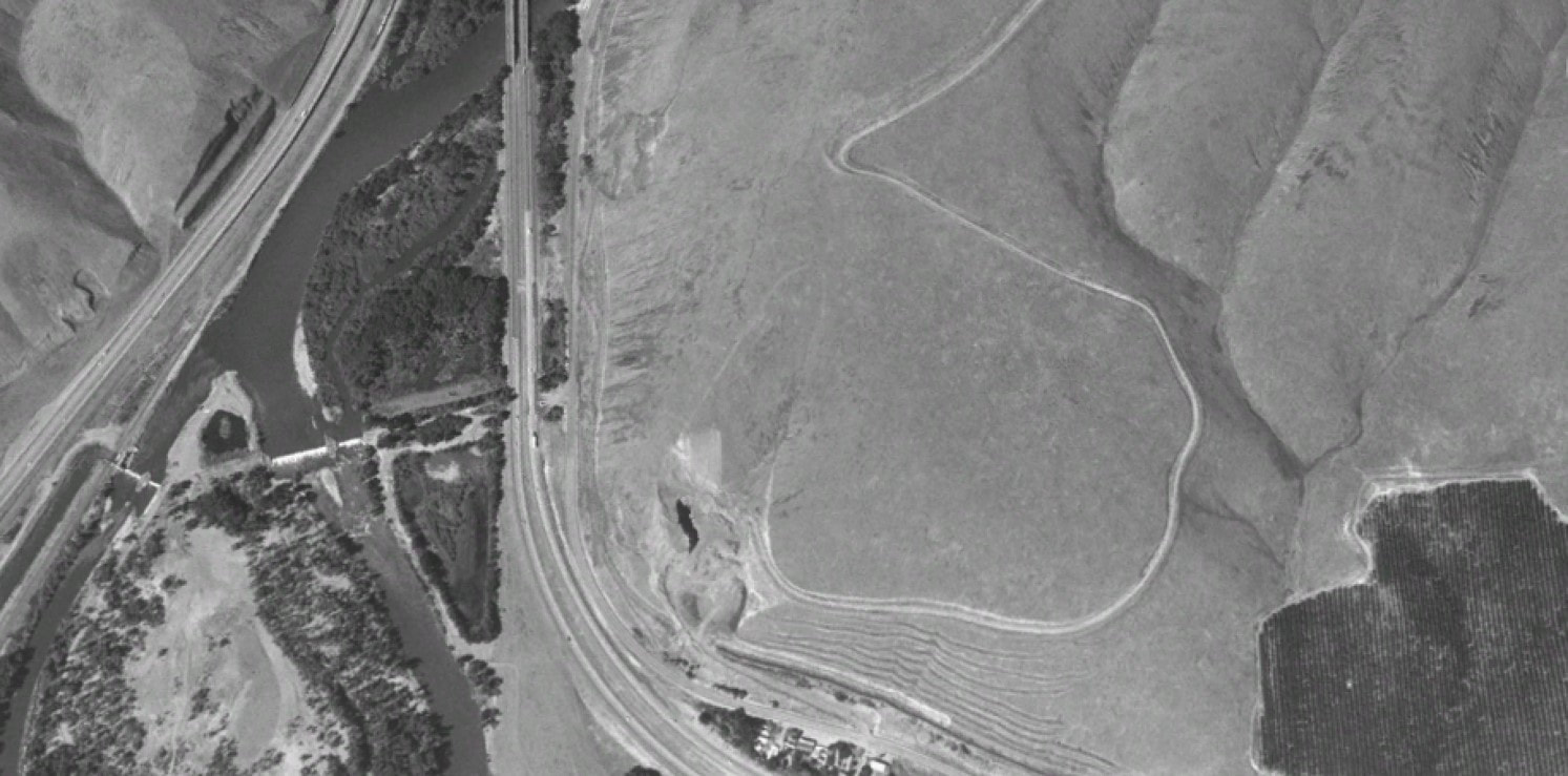
Google 1996 aerial view of RR.
RR before Quarry started.
IMAGES & VIDEO
|
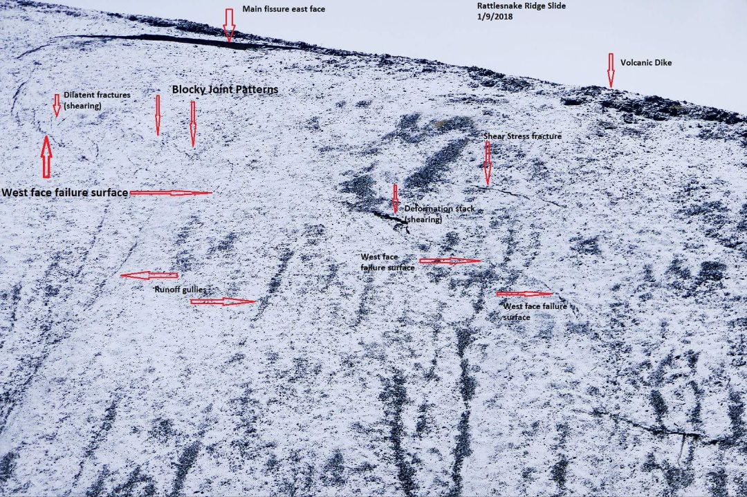
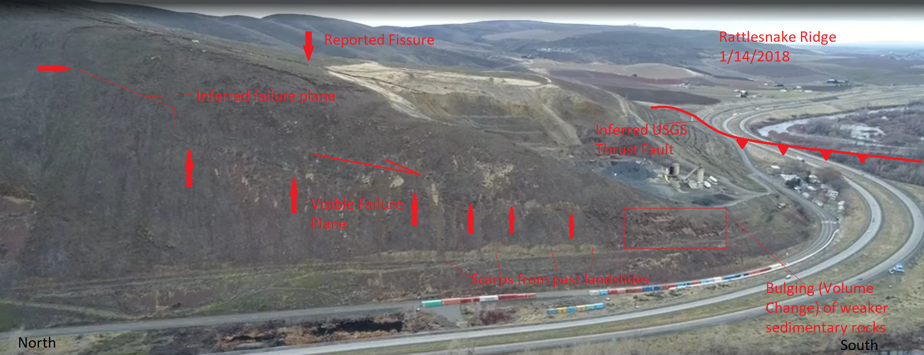
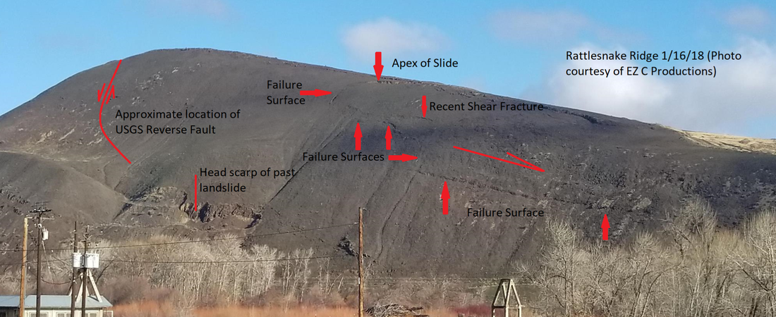
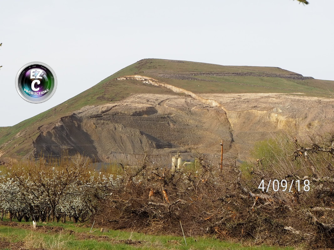
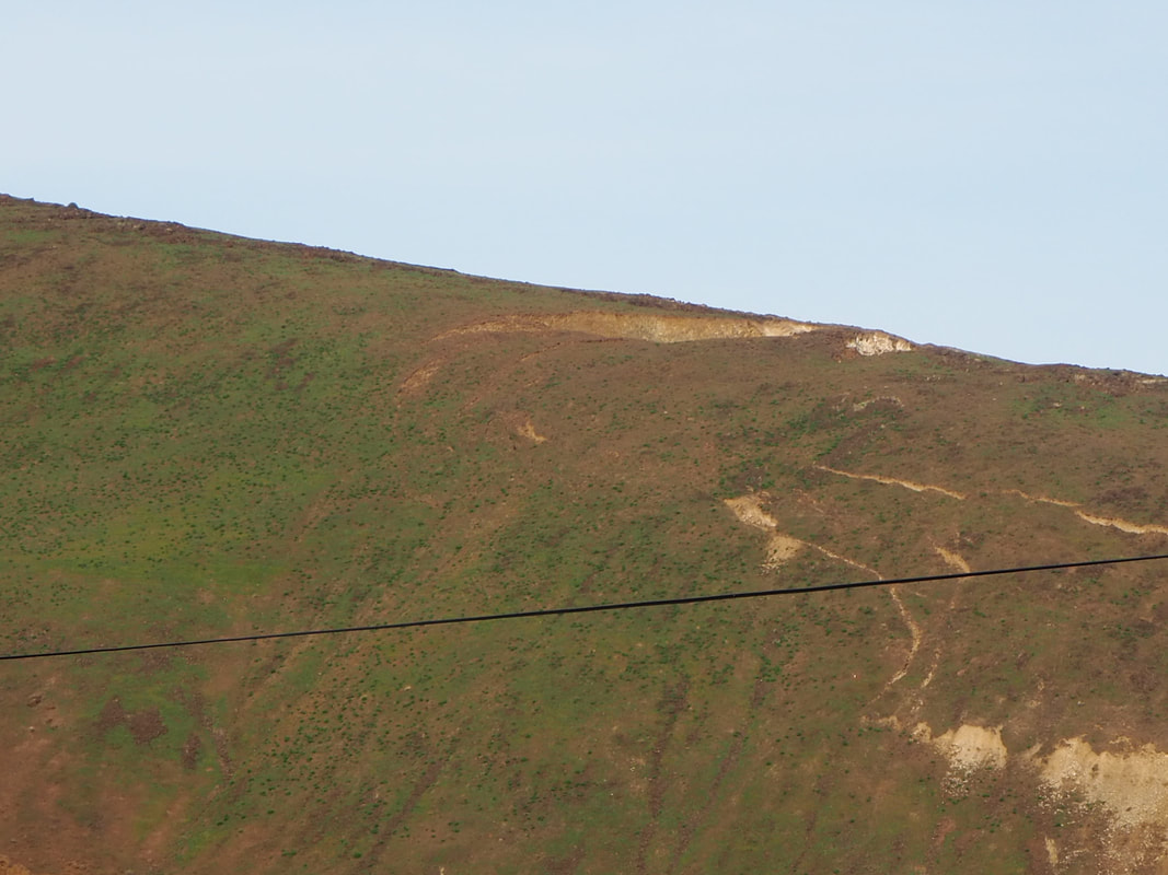
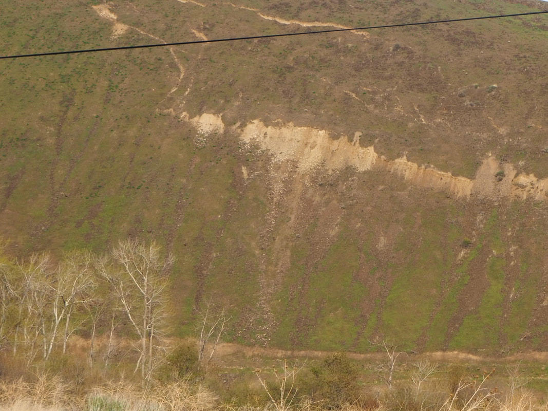
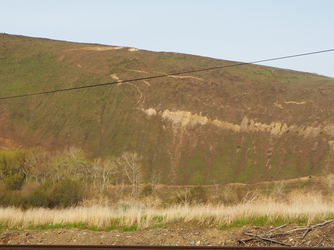
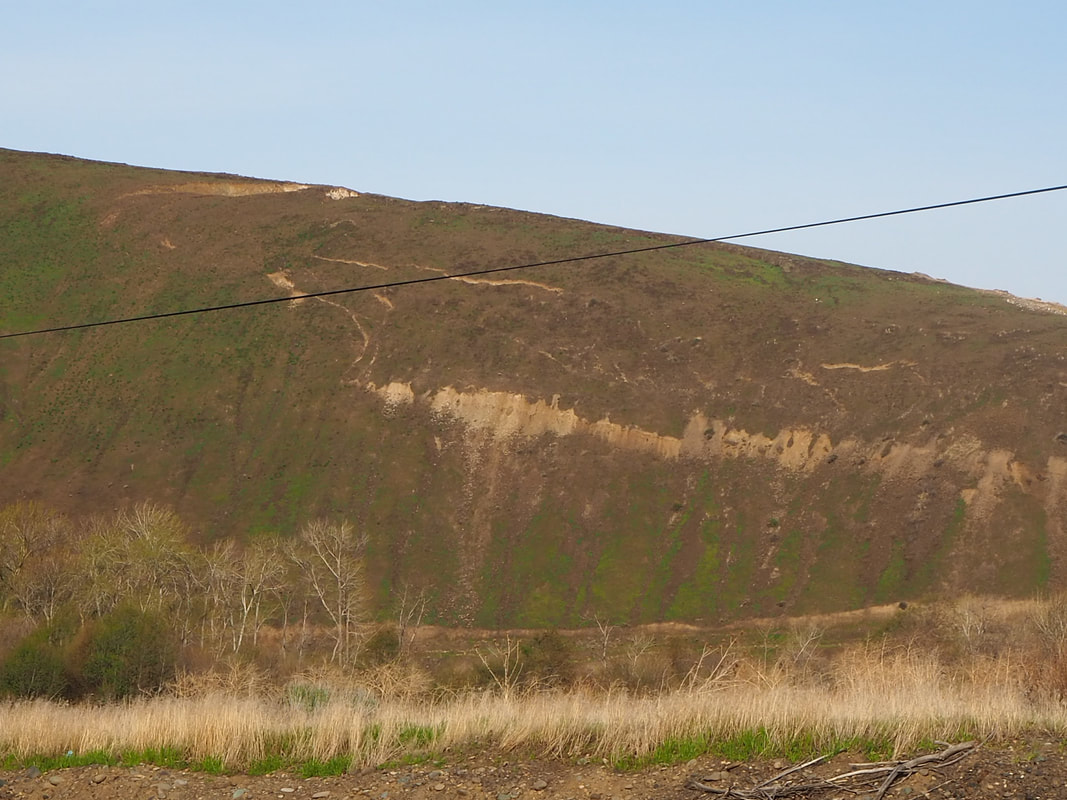
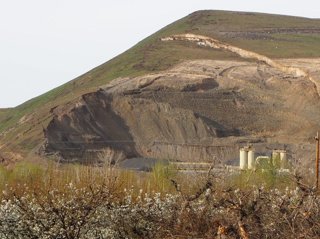
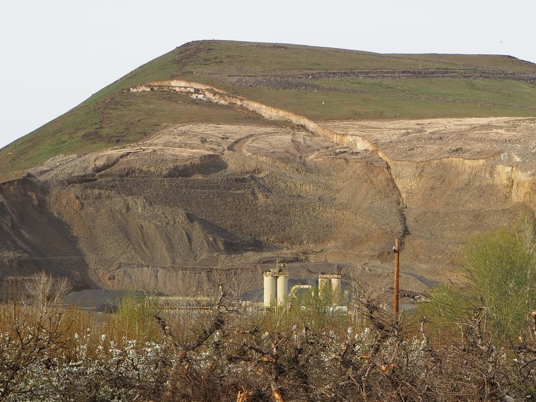
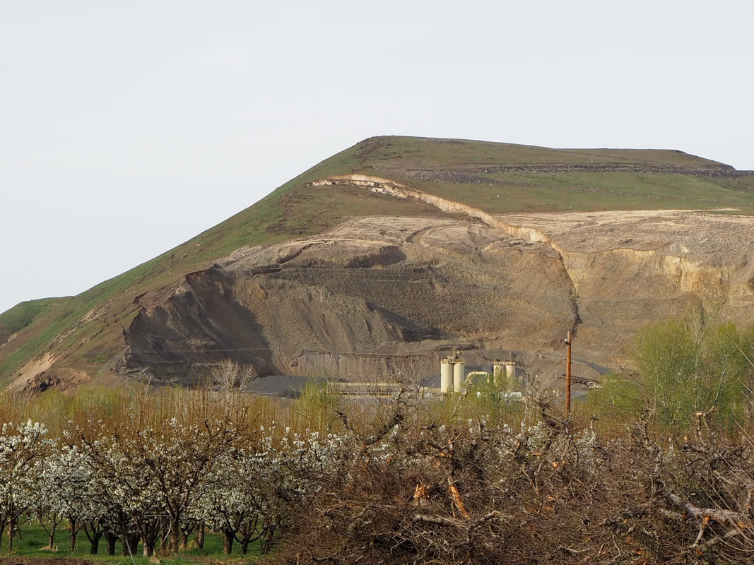
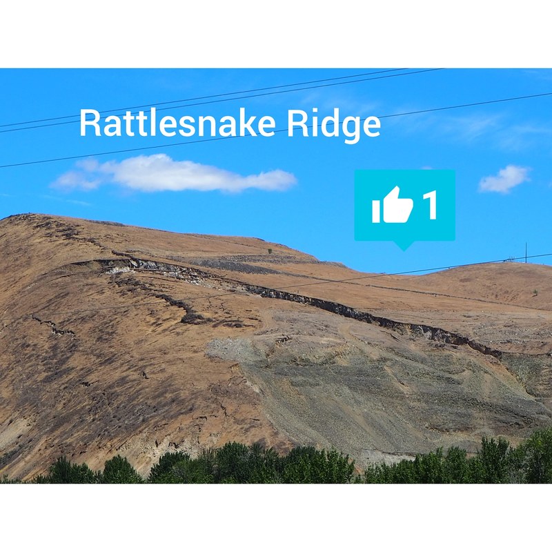
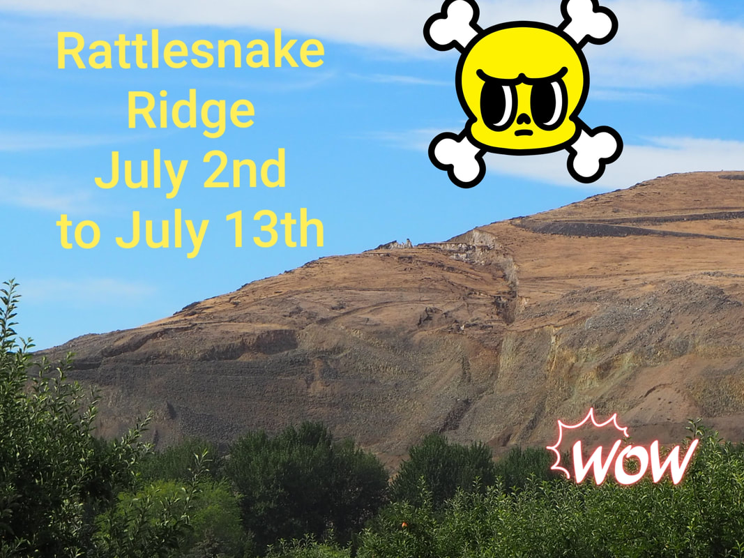
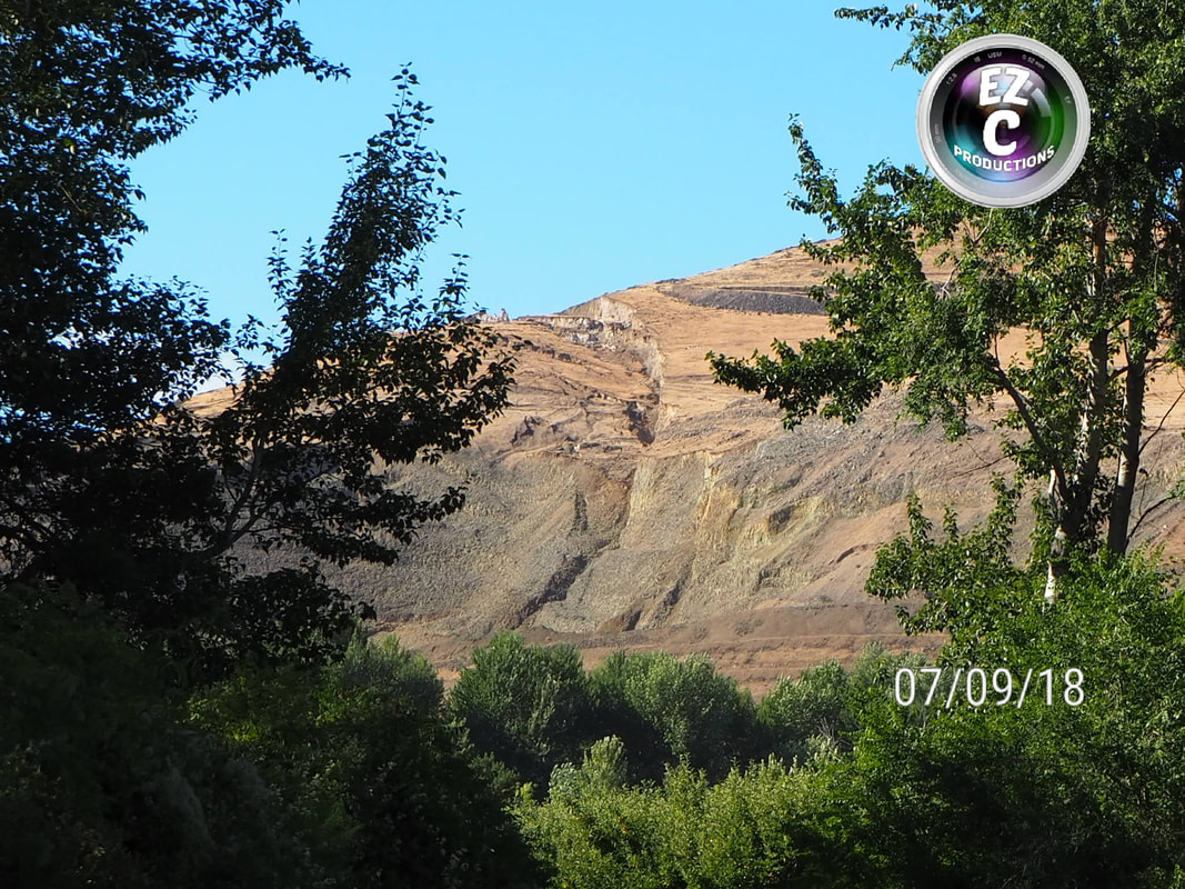
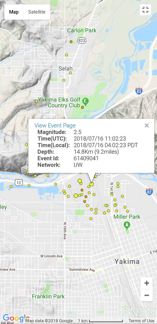
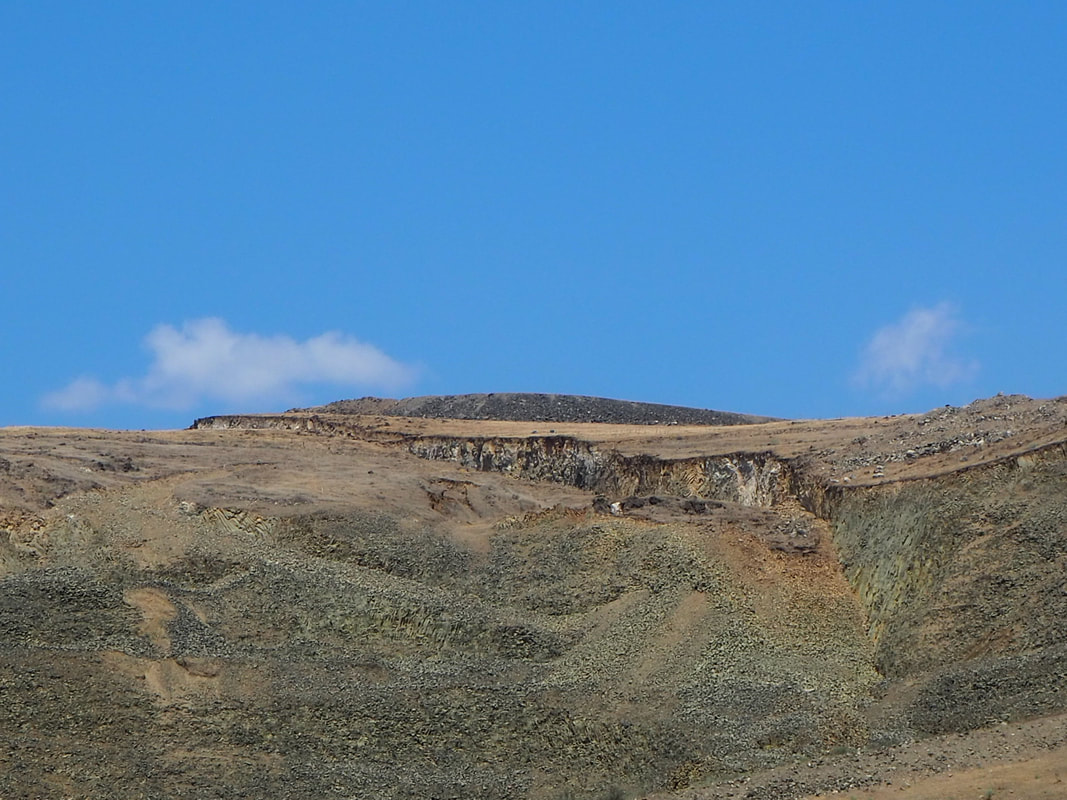
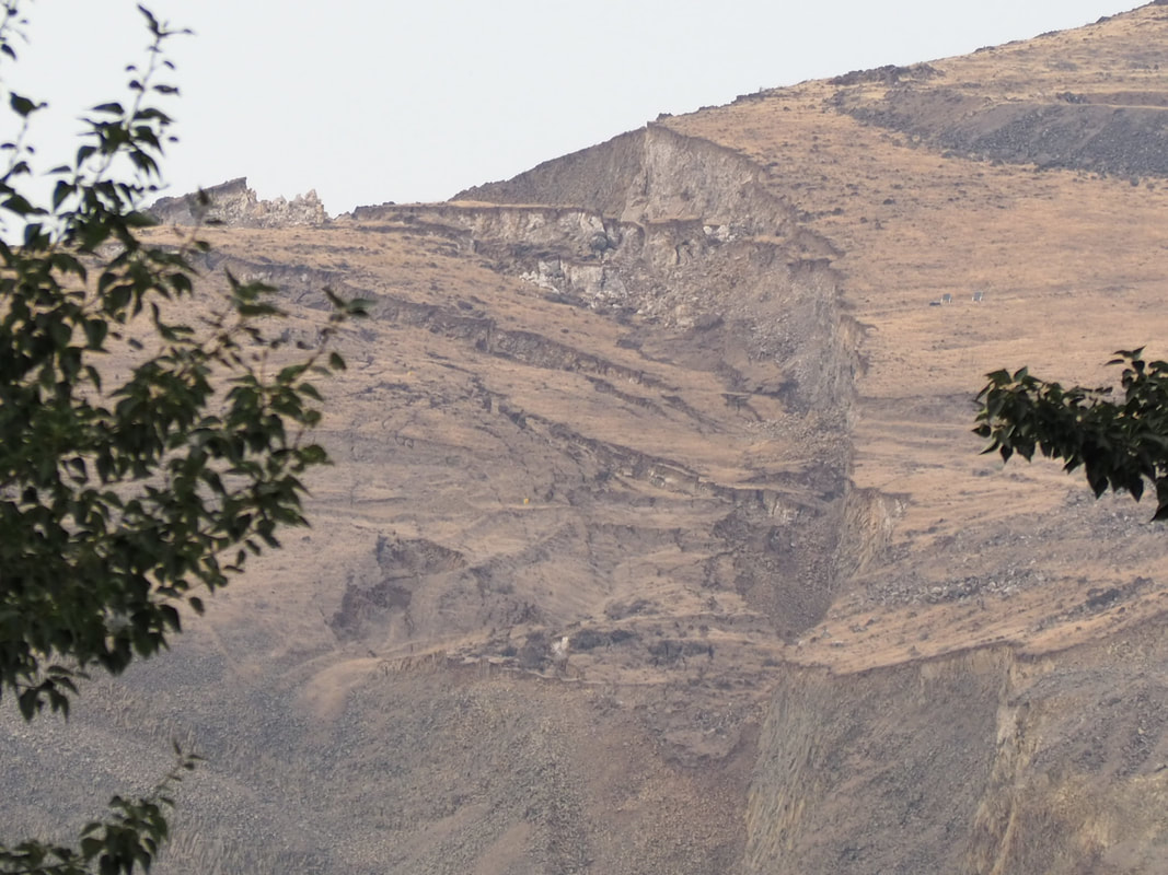
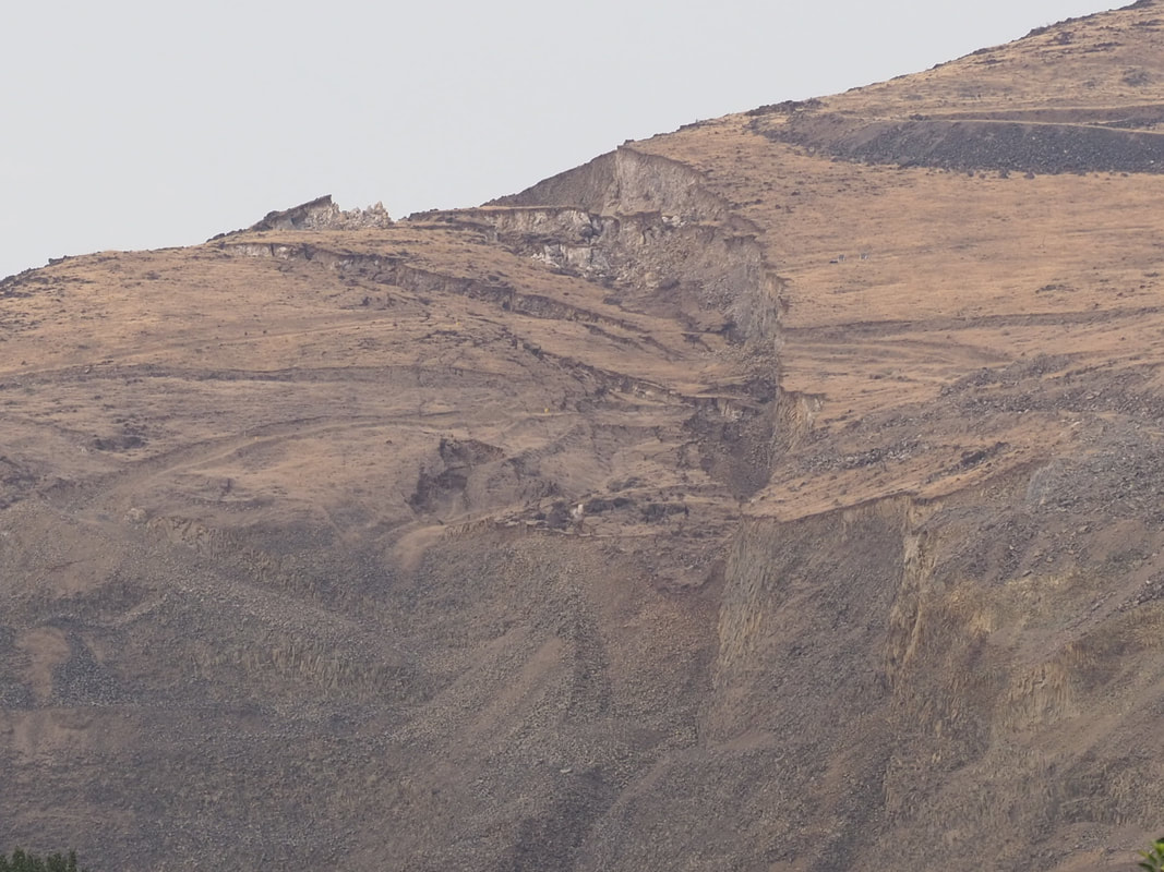
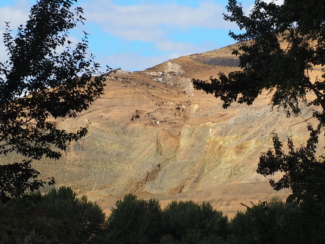
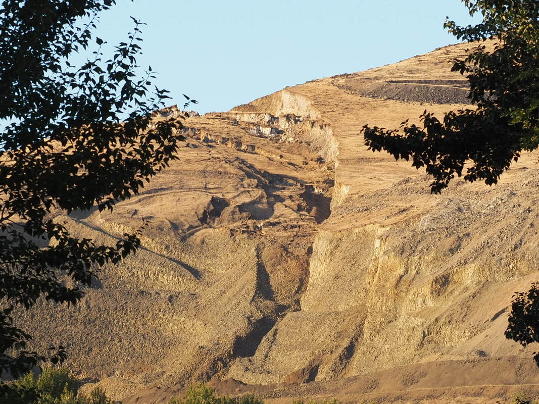
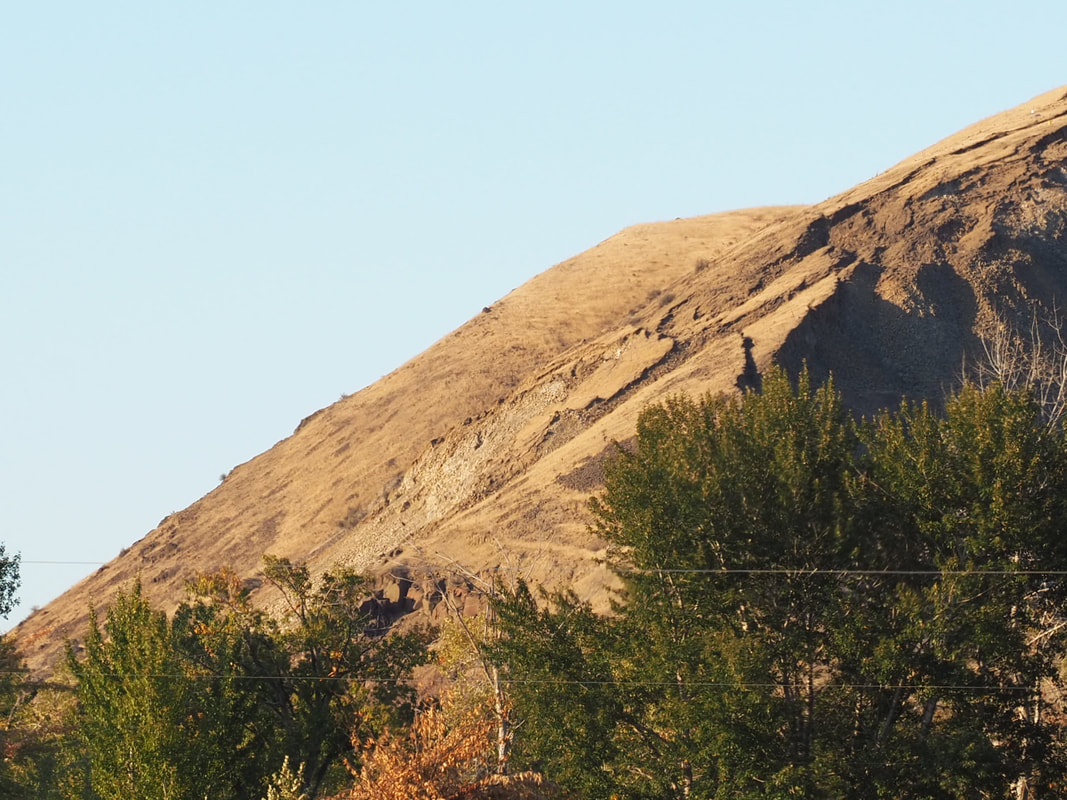
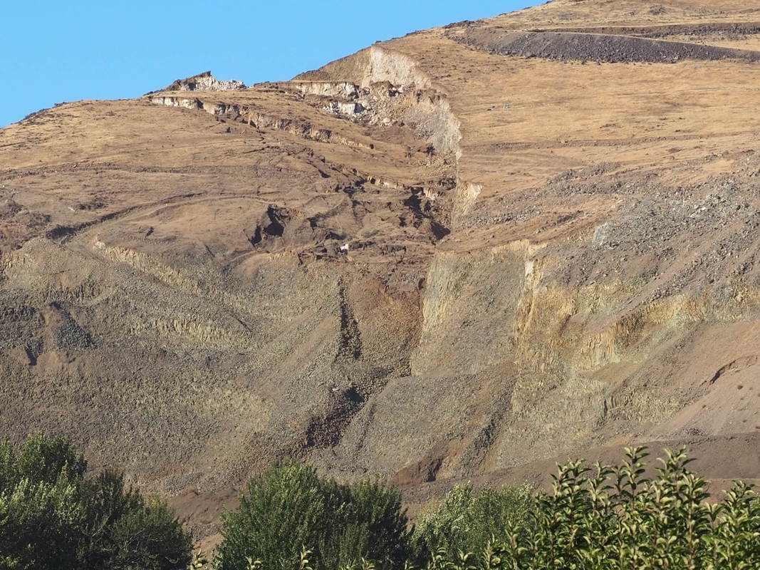
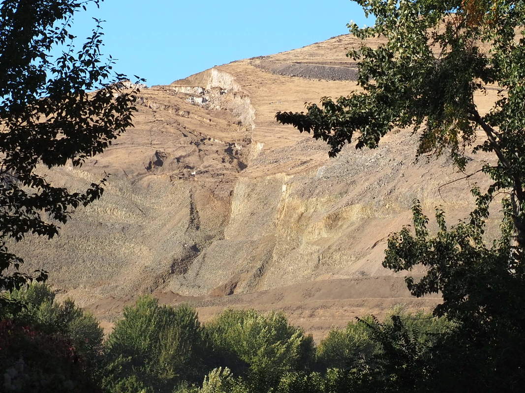
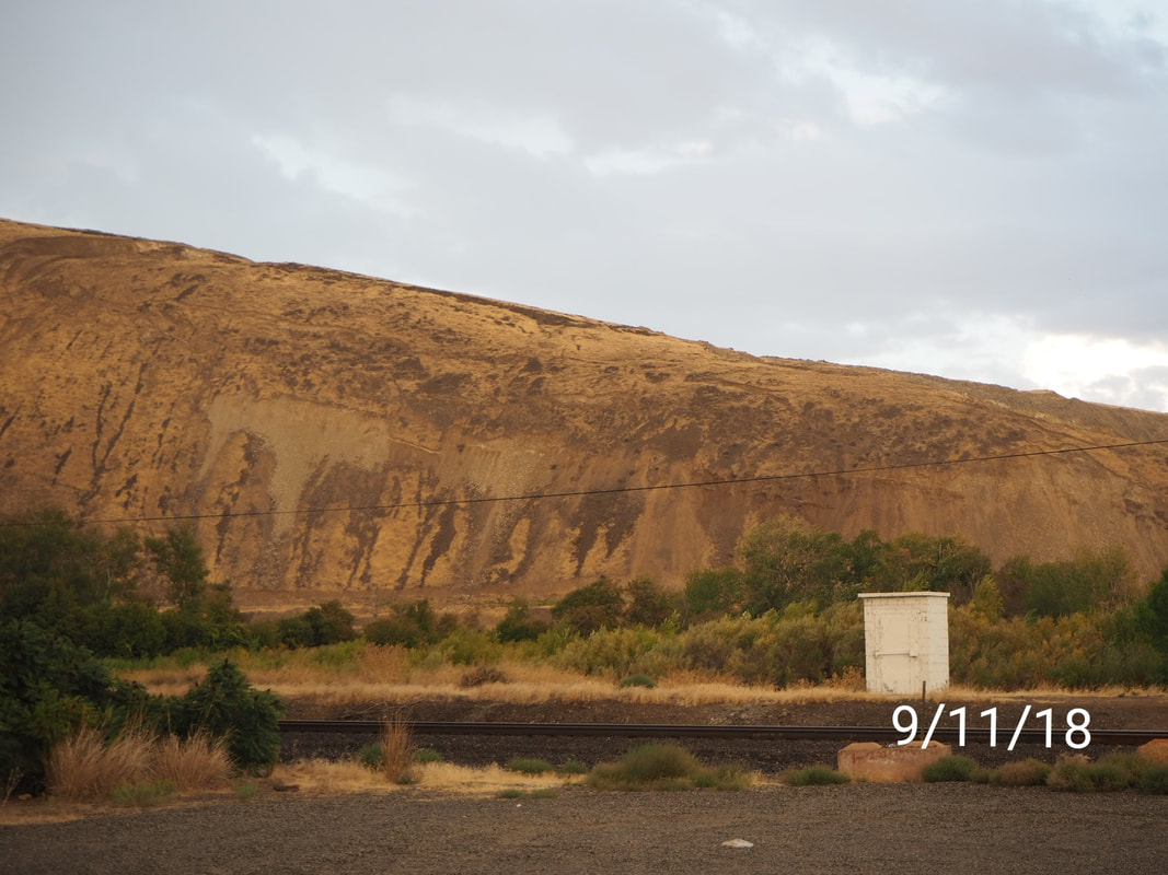
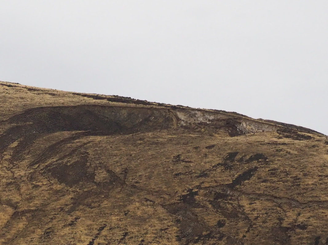
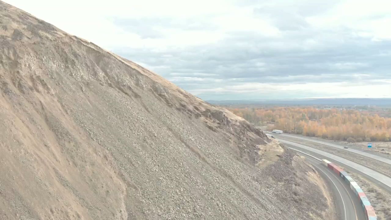
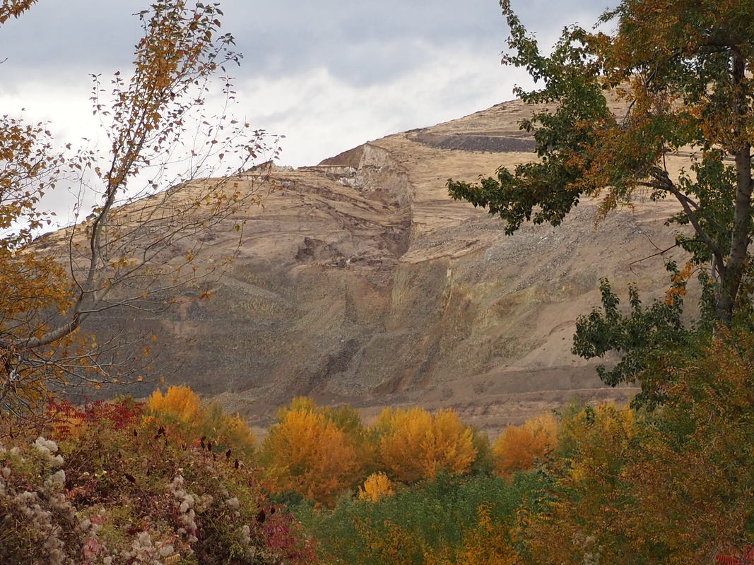
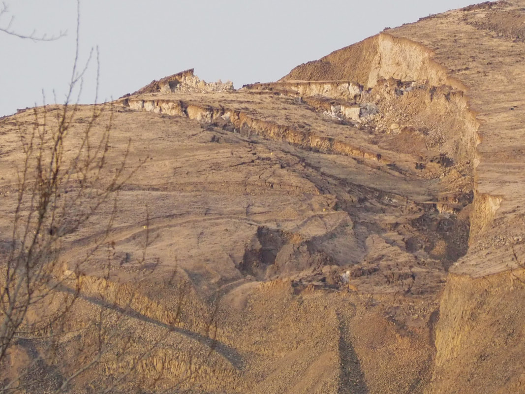
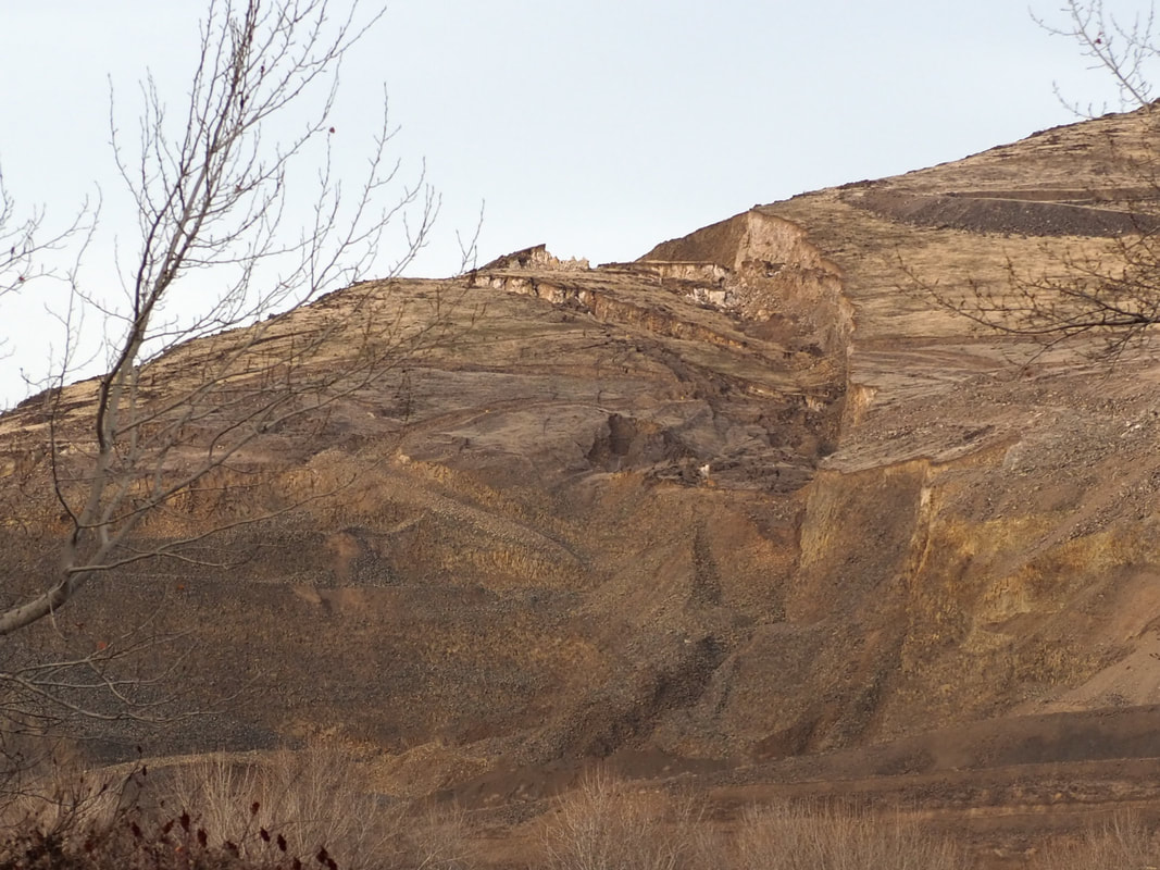
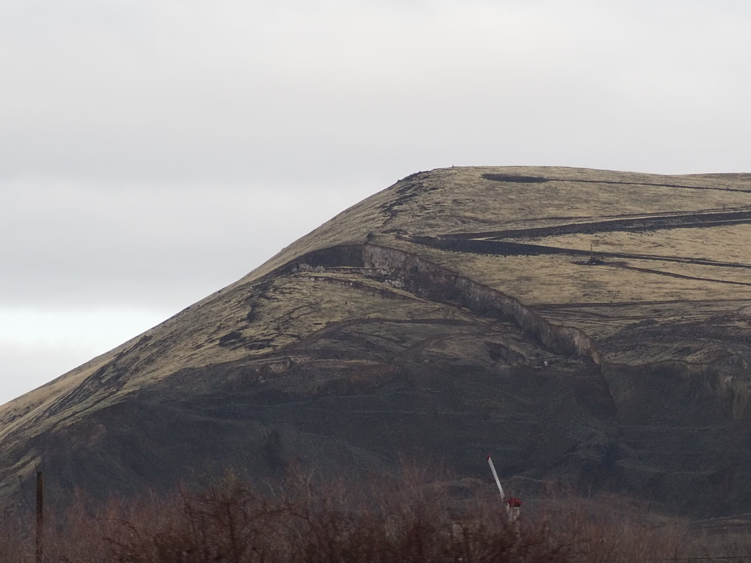
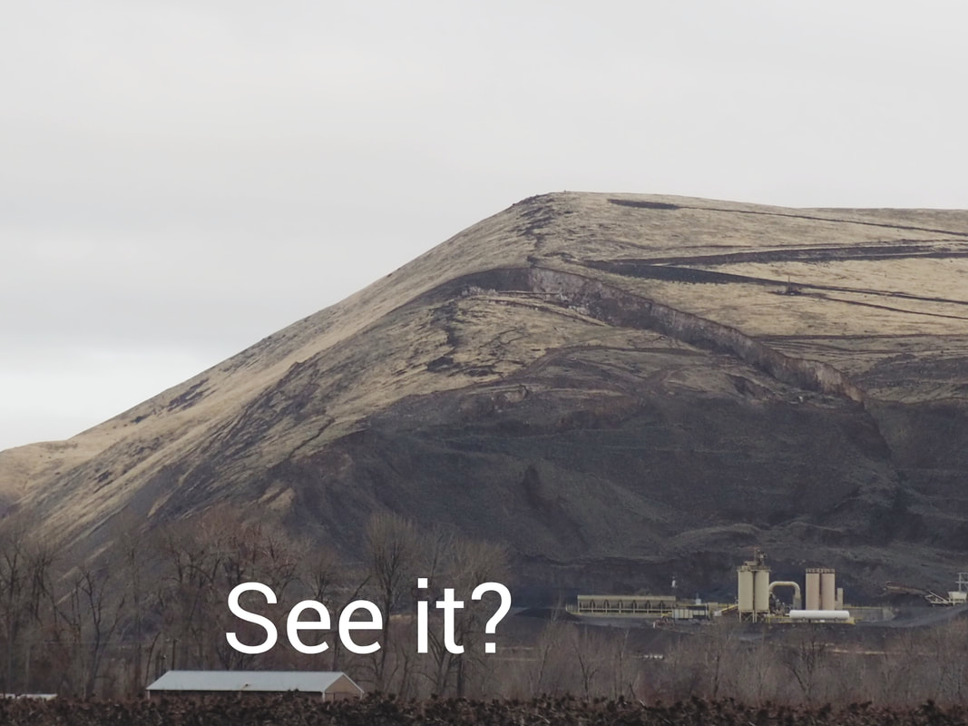
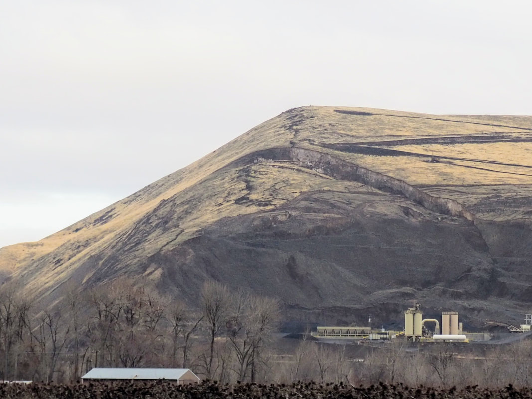
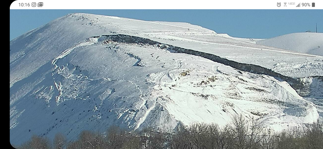
Rattlesnake Ridge (RR) sits 3 miles south of Yakima near Union Gap, Washington and is calculated about 20 acres of land that is currently moving at 1.5ft per week in a "southward" direction. The type of movement expected is a translational landslide made up of blocks of basalt sliding on a weaker sedimentary layer. The geologists and engineers monitoring the landslide suggest that it would probably slide toward the south and into the quarry and onto Thorp Road.
Here I continue to document and upload videos to my Youtube channel showing the movements of the slide. Thank you for visiting and feel free to chime in and post your observations. You will see below that I have created a campaign to raise money to purchase a drone, any amount would be much appreciated, Thank you! |
|
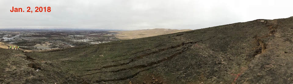
January 16th to April 24th of 2018 animation
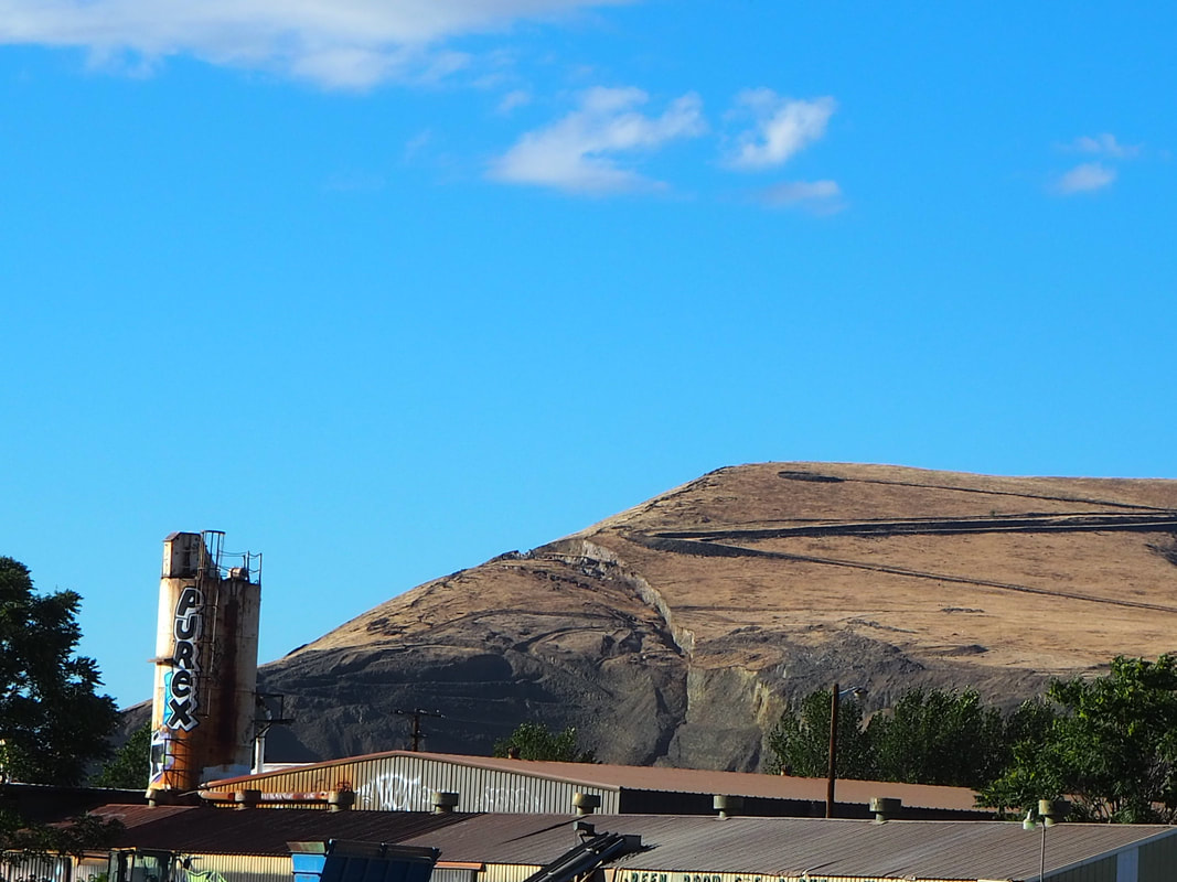
Quarry view over time
Here is an animation of some images from January of 2018 to April 2018. You can see changes throughout those dates.
geology mock ups of rattlesnake ridge
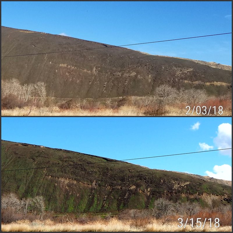
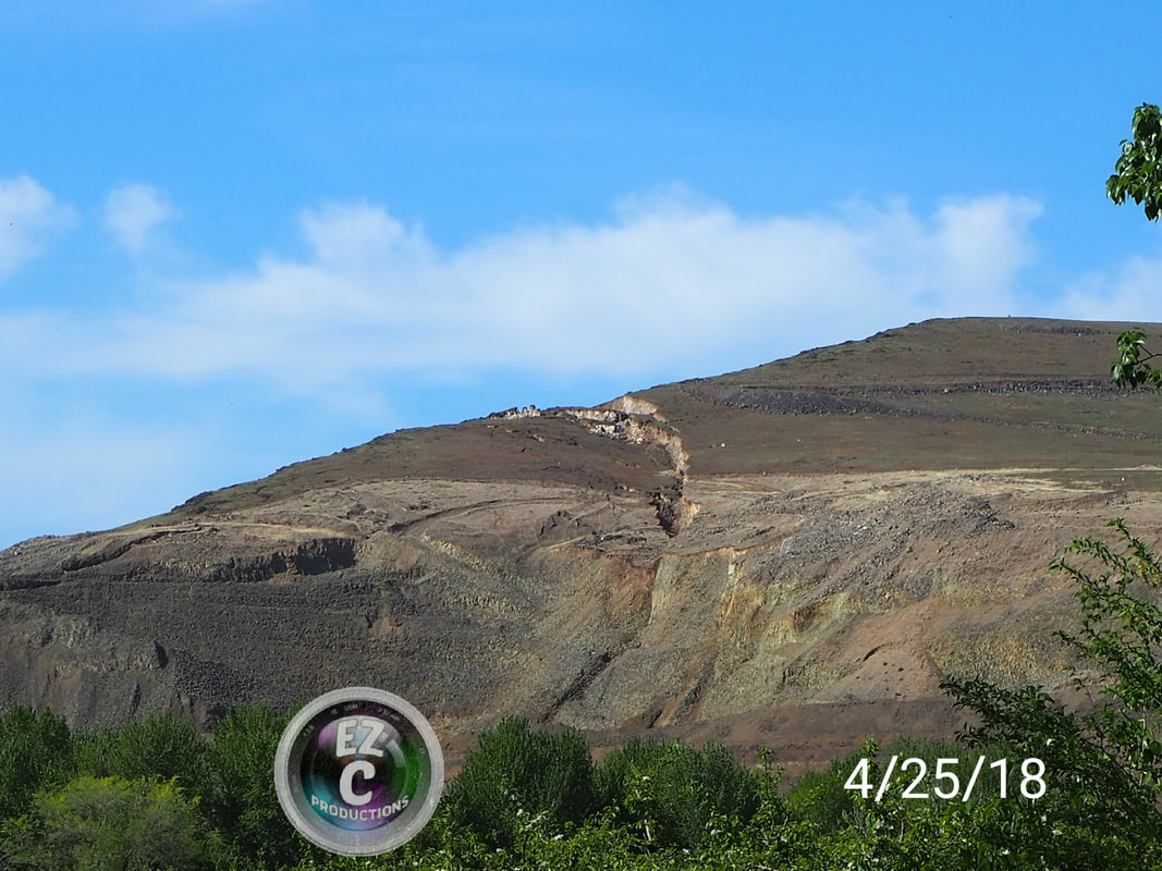
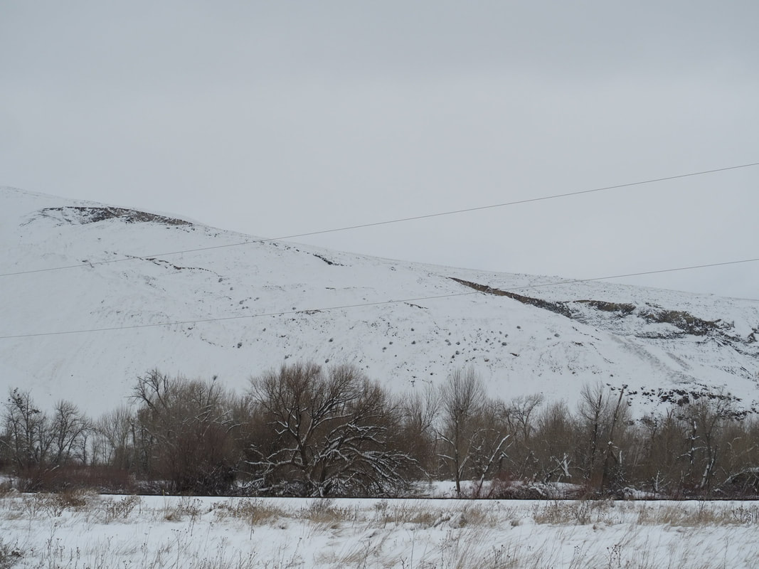
April 2018
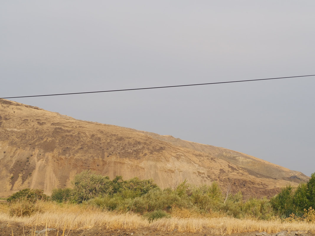
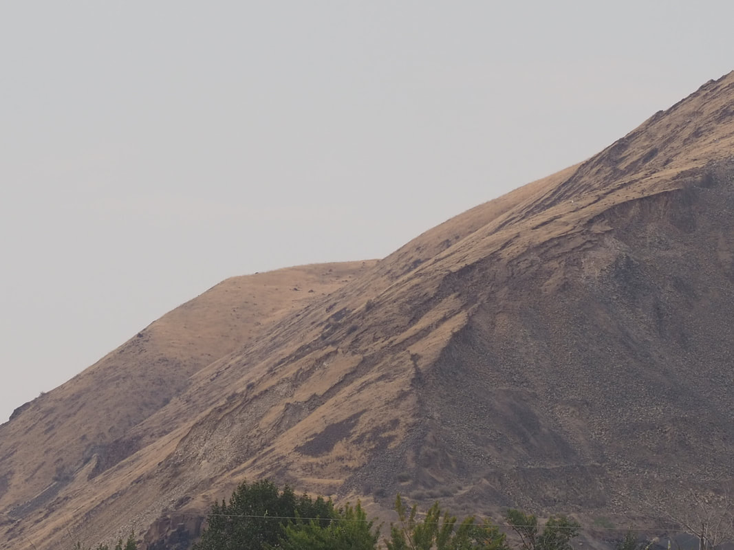
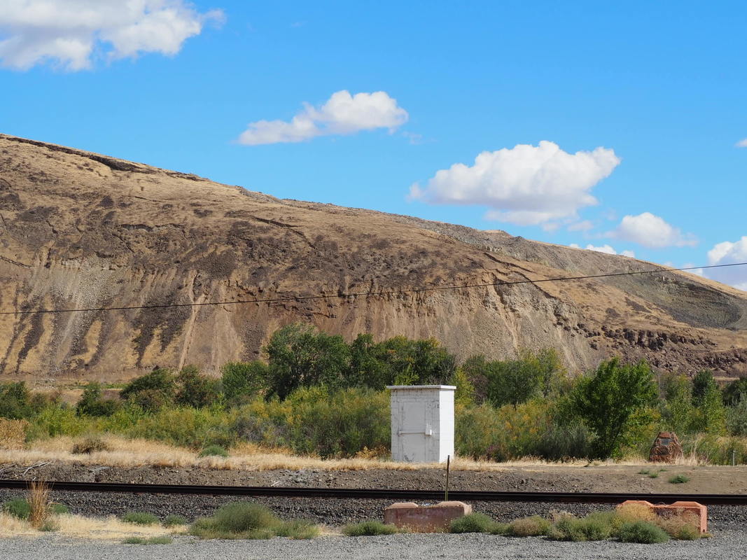
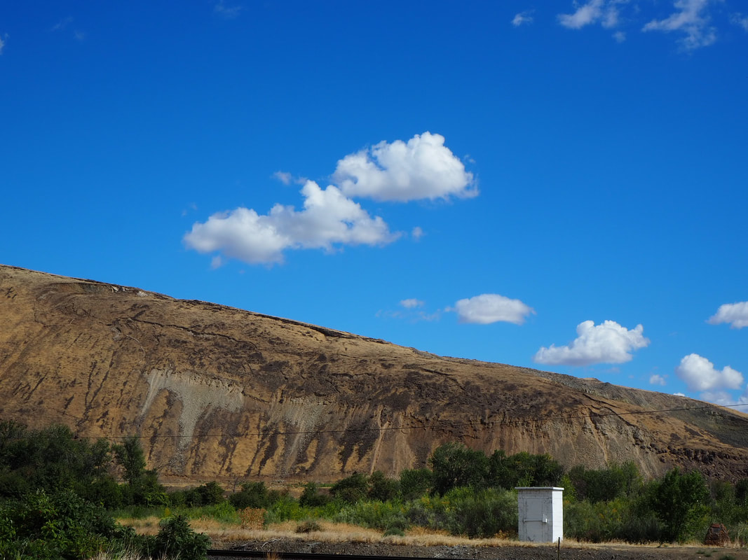
Here are some images taken from Quarry view and west face view. The week and weekend of Spring Break, Yakima received about 3 days of rain. I set out on the 6th to capture images of the RR.
See below for your viewing pleasure.
See below for your viewing pleasure.
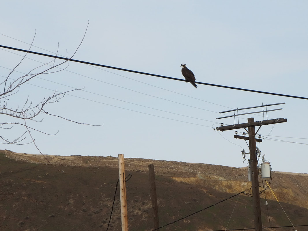
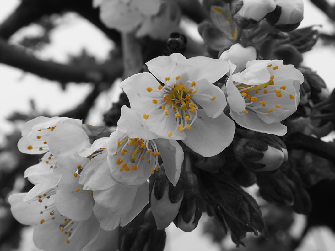
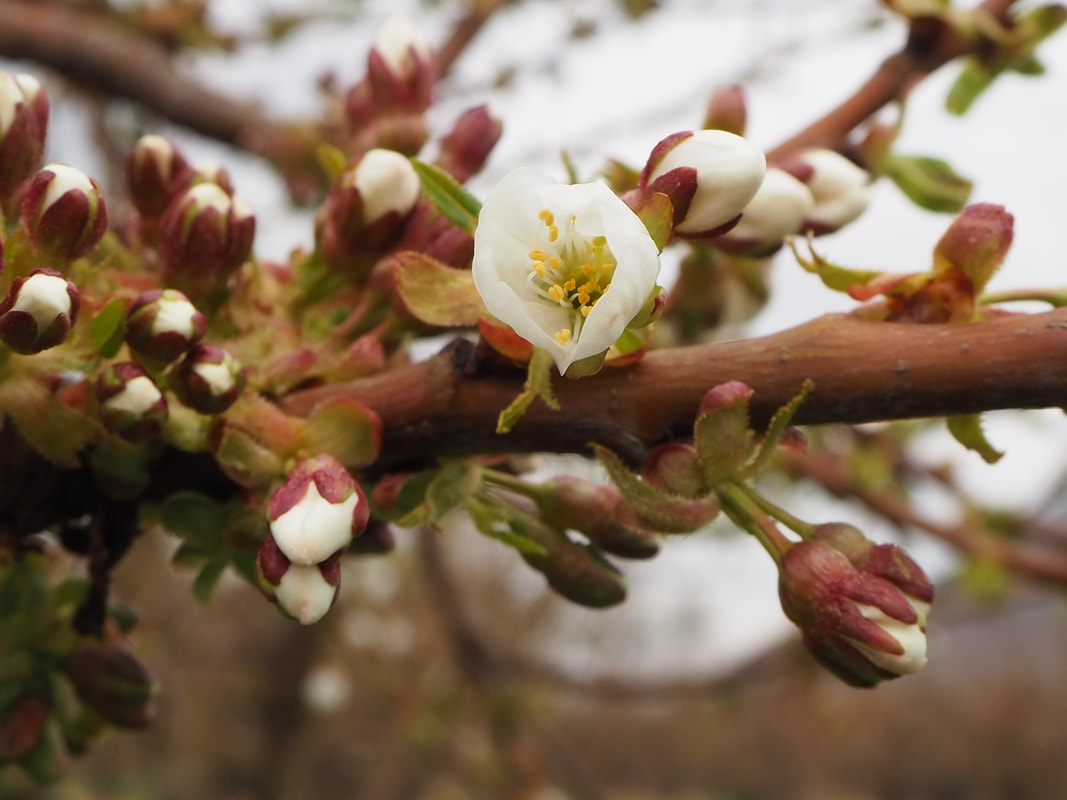
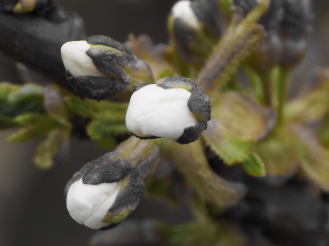
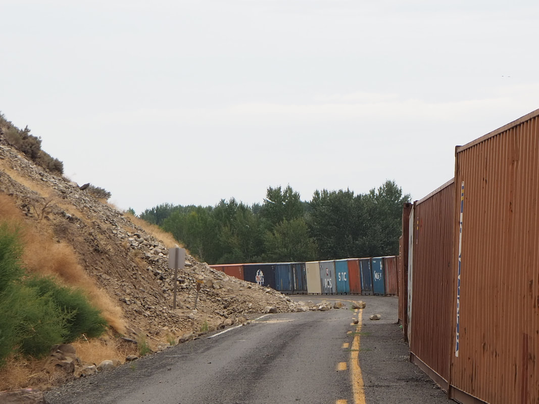
Gallery below includes nature surrounding the Rattlesnake Ridge.


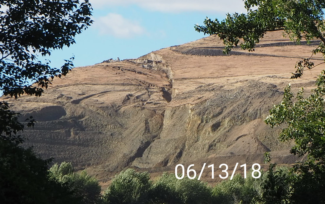
June 13, 2018
A couple of news articles came out today about the status on the RR. A drone video is also provided by DNR
https://media.king5.com/embeds/mobile/video/281-8158145/amp#amp=1
https://media.king5.com/embeds/mobile/video/281-8158145/amp#amp=1
June 28th & July 1st
July 1st
Yakima had about 13 earthquakes today July 13th, 2018!! New video, come like and subscribe! Xoxo
July 2nd to July 13th
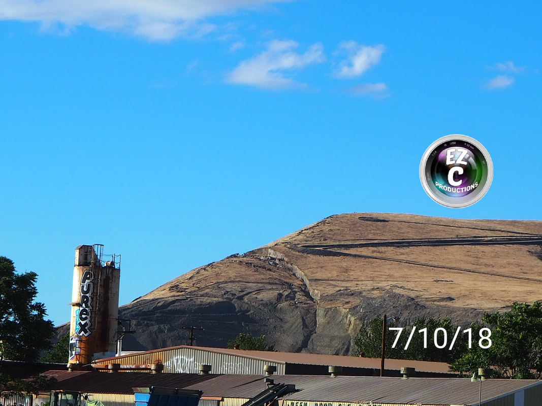
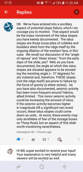
Recent images with comments from my geologist Bill, thank you!
|
|
|
July 19th Updates
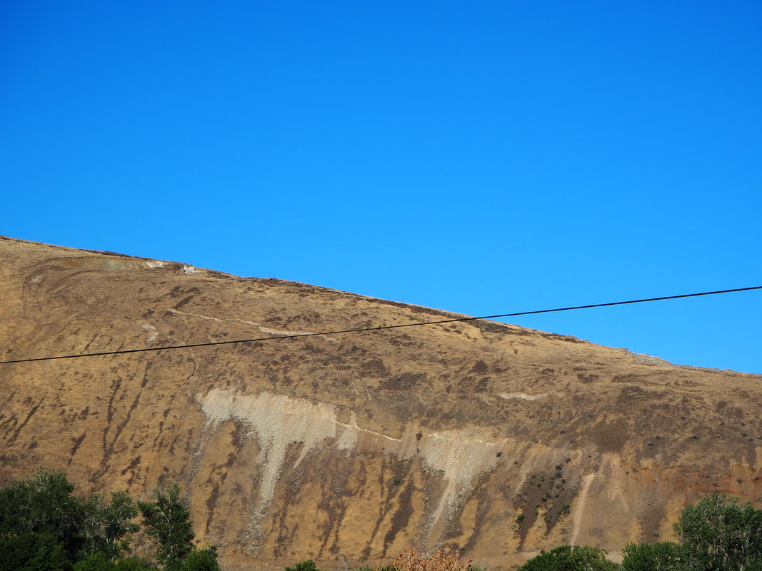
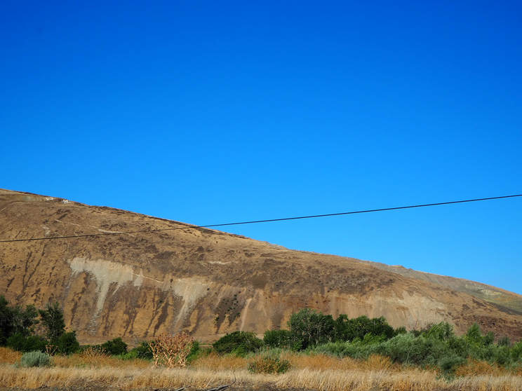
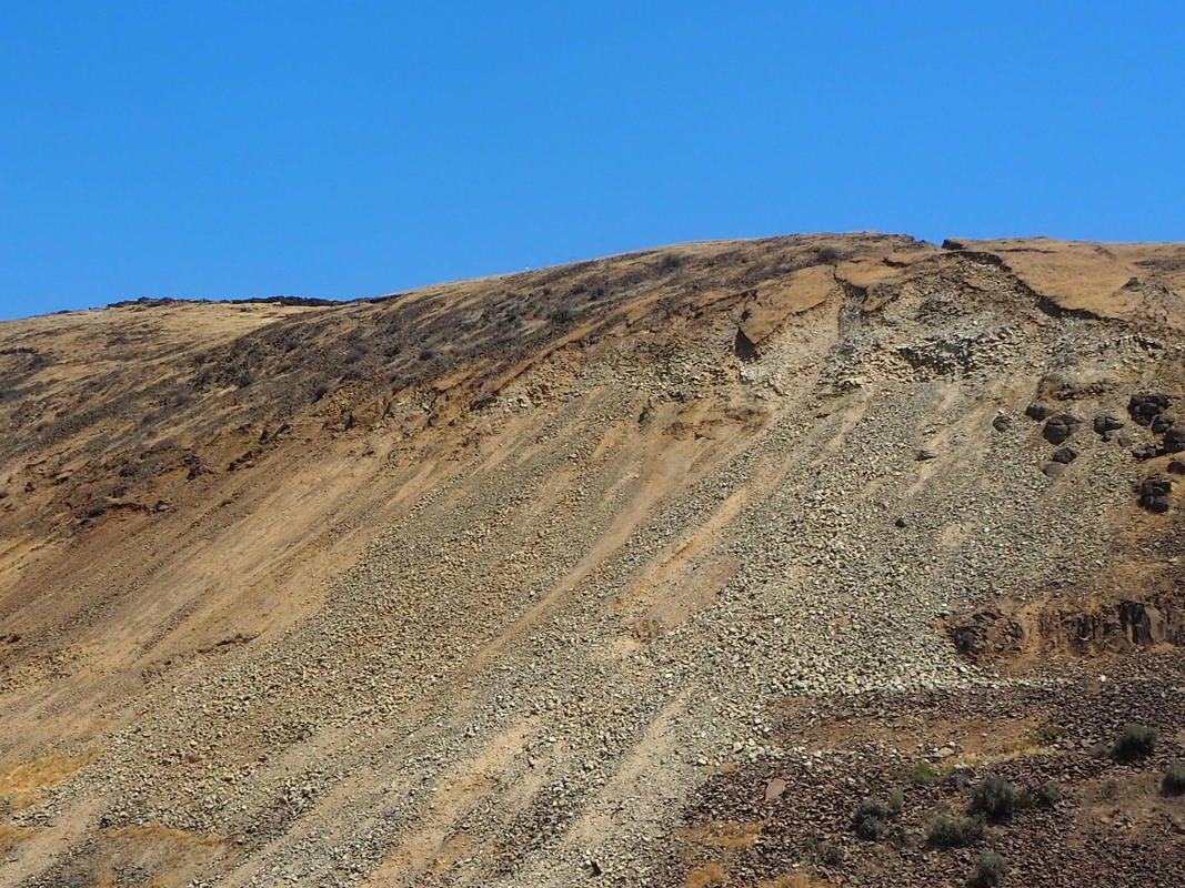
Western Face
Looks like a leaky irrigation canal?
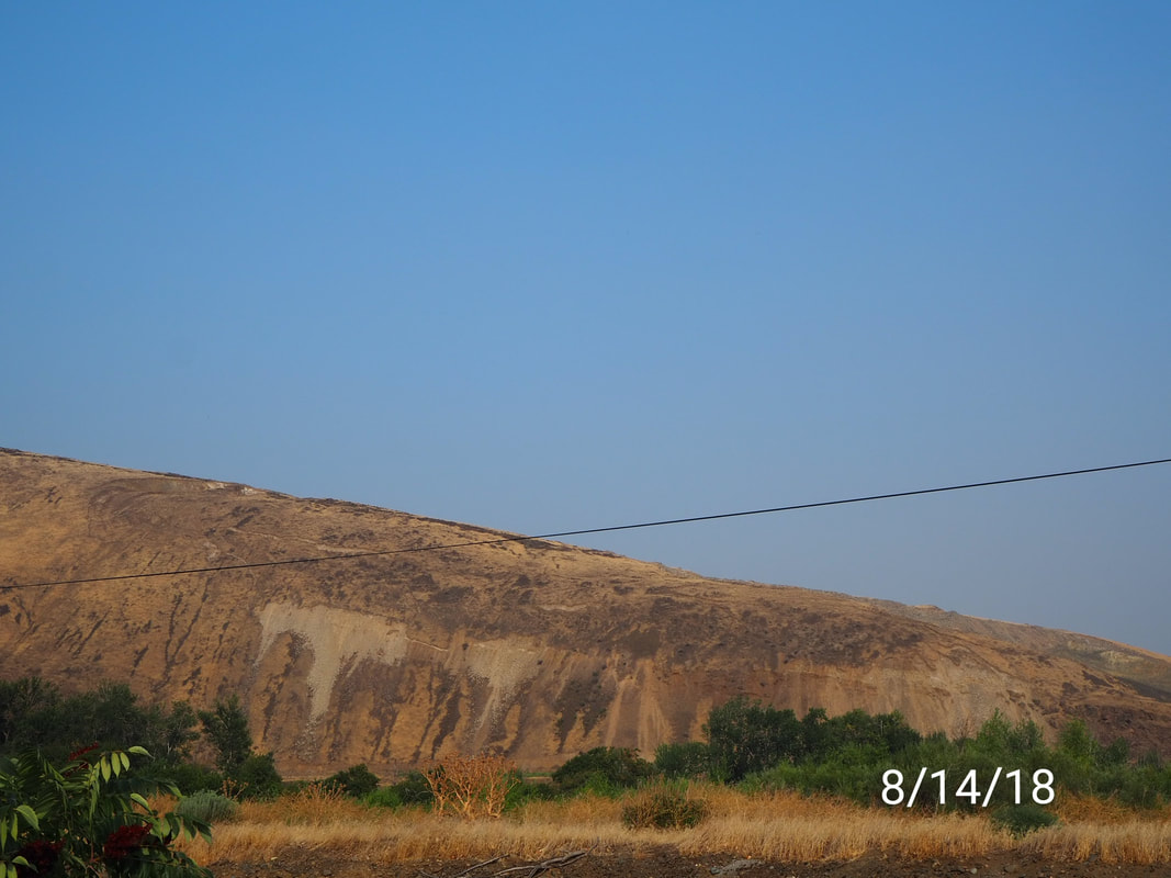
August 14, 2018 Newest Video
Fires surrounding Yakima County
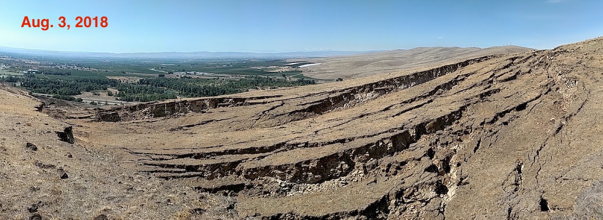
August 2018

September 2018


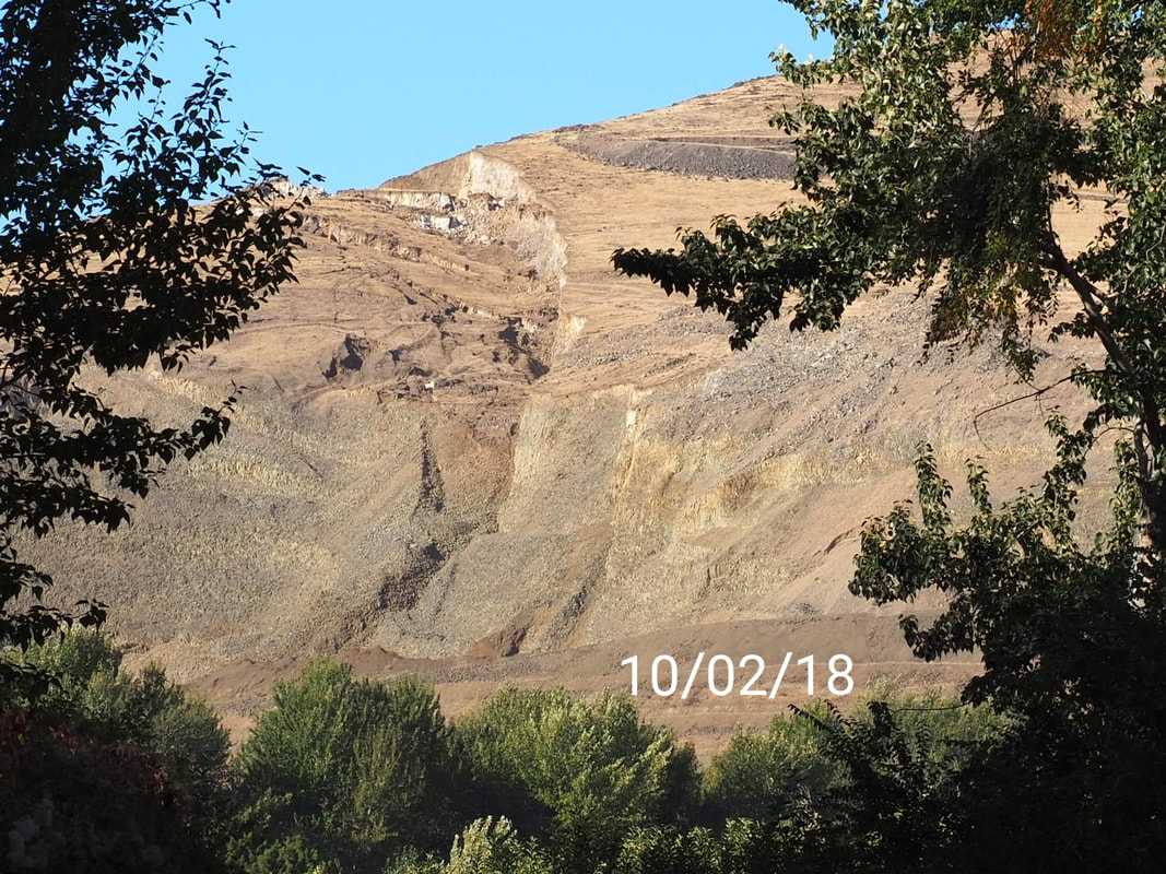
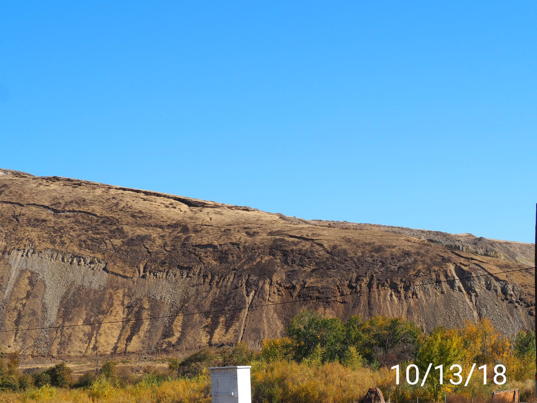
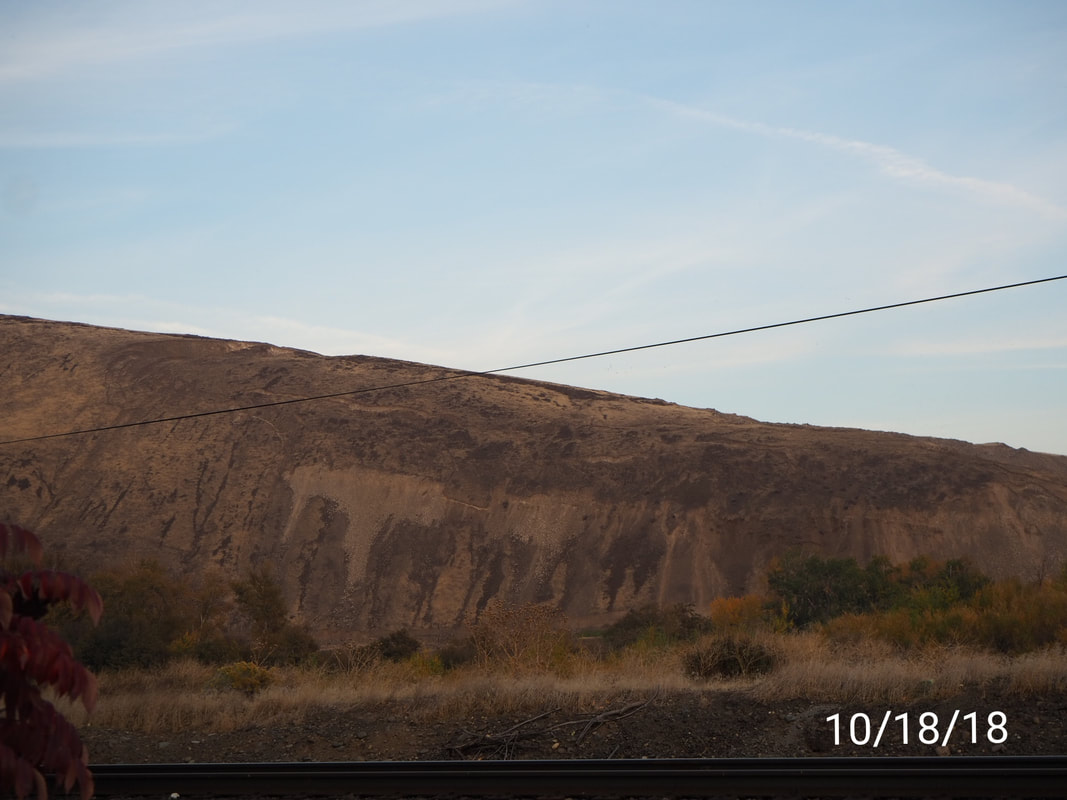
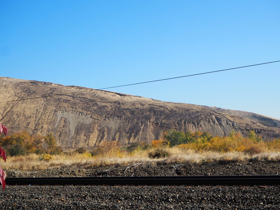
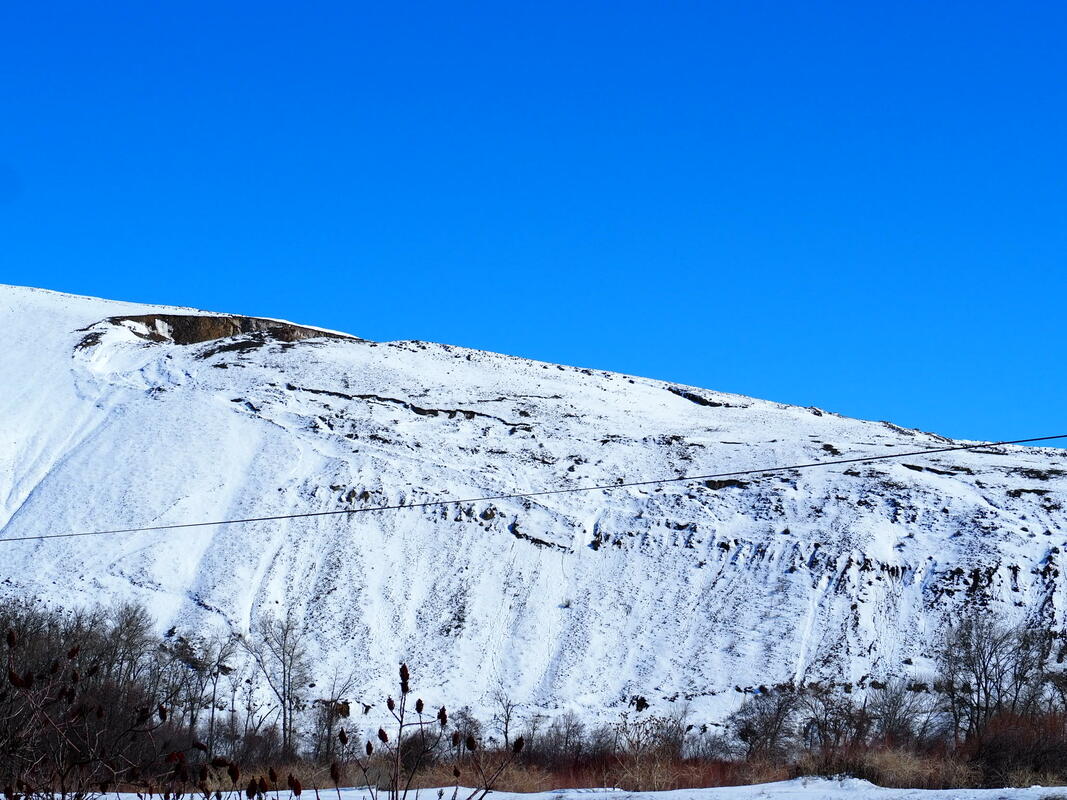
October 2nd to October 18th
Compared view from June and October, visible changes have taken place.
|
|
|
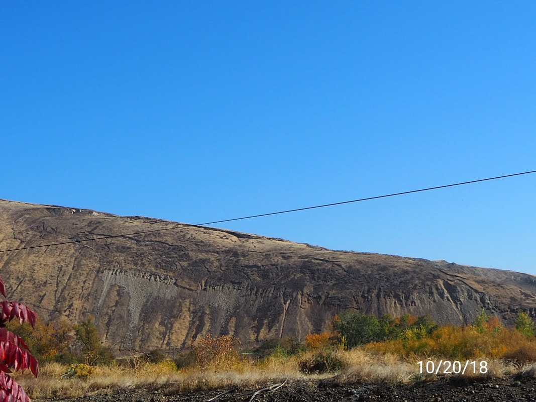
10/20/18
|
|
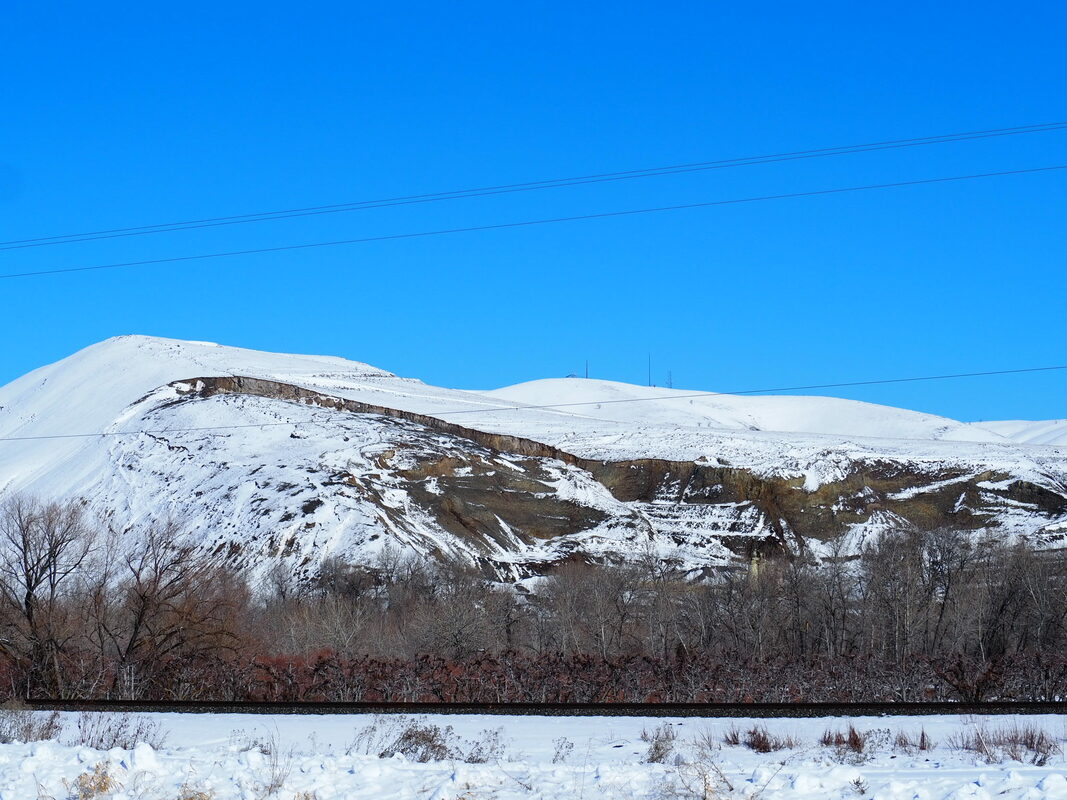
Oct 28th to Nov 12
West face

|
|
Great clips that I forgot to add to my Nov 12th video post. Here ya go!
Nov 23, 2018
Update 12/07/2018 from PNSN
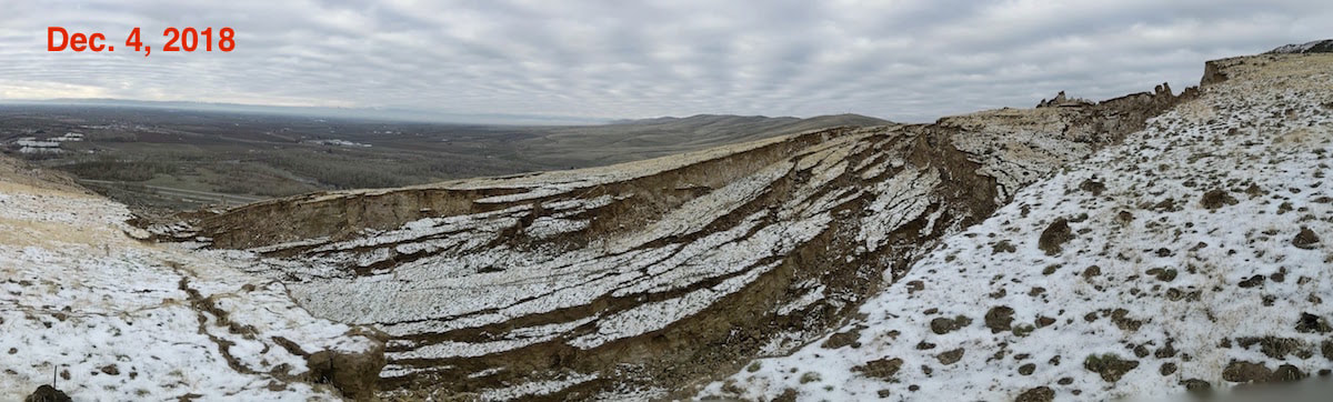
Alright, so here are some amazing pictures provided by PNSN on an article written on December 5, 2018 by Steve Malon. A follower on my EZ C Productions Facebook page added the link with the article (thank you Charlene). I shared the pictures to show the changes to the RR from Jan to Dec of 2018. Even though PNSN will stop monitoring at this time, this RR will continue to move, and yes it may be slow but it is still moving. PNSN reports the equipment installed at the RR has stopped working due to technical issues or chewed cables by deer or elk. PNSN decided to pull out their equipment until geologists report increase in movement.
Nonetheless, the RR continues to be monitored by University of Oregon and you can find that article here. PNSN reports even though they have removed their equipment "the slide is still moving and is still being monitored geodetically".
As for my documentation? I will continue to record and post for your pleasure (really, mine). I live here and I find this Once in a Lifetime to be able see it happen before my eyes and so close to home.
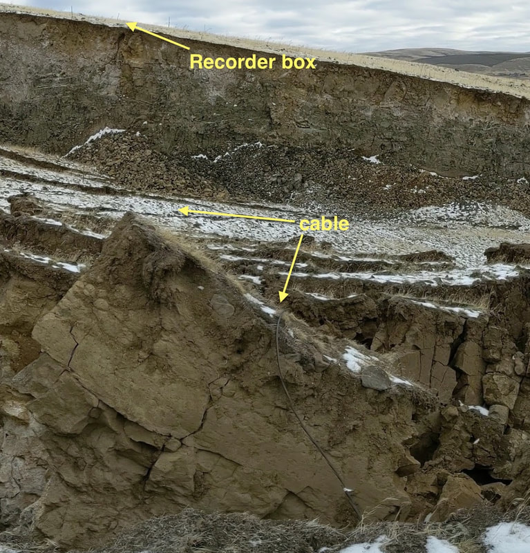
"The long cable between the equipment box and the sensor for UGAP6 out on the landslide block was also cut. However, in its case the culprit was a rockfall from the 10-12 meter scarp down which the cable went. Here is a photo taken from near the UGAP6 sensor back along the cable toward the recording box. Note the rockfall directly below the recorder. It was too hazardous to approach the rockfall area to check it out in detail so the cable was abandoned". PNSN
THis Just in...kima news
KIMA news reported December 6, 2018 that Columbia Asphalt will install "equipment" on the RR to monitor water levels under the ridge. "Things that make you say, Hhhmmm". I mean in all reality it is great to continue to monitor the slide, so maybe we'll see updated date once Columbia Asphalt has gathered that date. It would be interesting indeed.
Here is the article, click here. According to Emergency Management Team states they are adding more equipment to collect data and nothing to worry about. People driving by I82 will see activity up there but not to worry.
DNR also agrees that it's nothing to worry about and won't impact the slide; equipment will be next to the slide. They plan to install the equipment up until January 2019.
I work Mon-Fri with a nine hours shift but I will make time to drive there during daylight. Be sure to come back and to subscribe to my Youtube channel, click here for ongoing updates and recordings.
What are your thoughts?
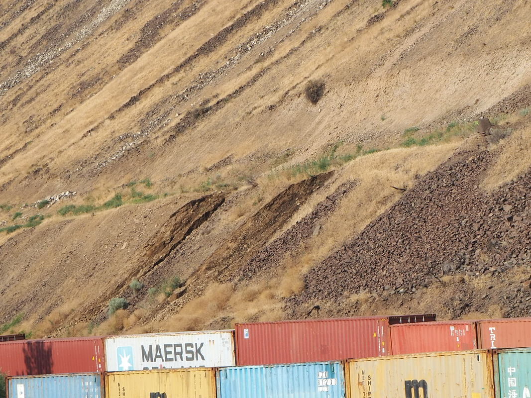
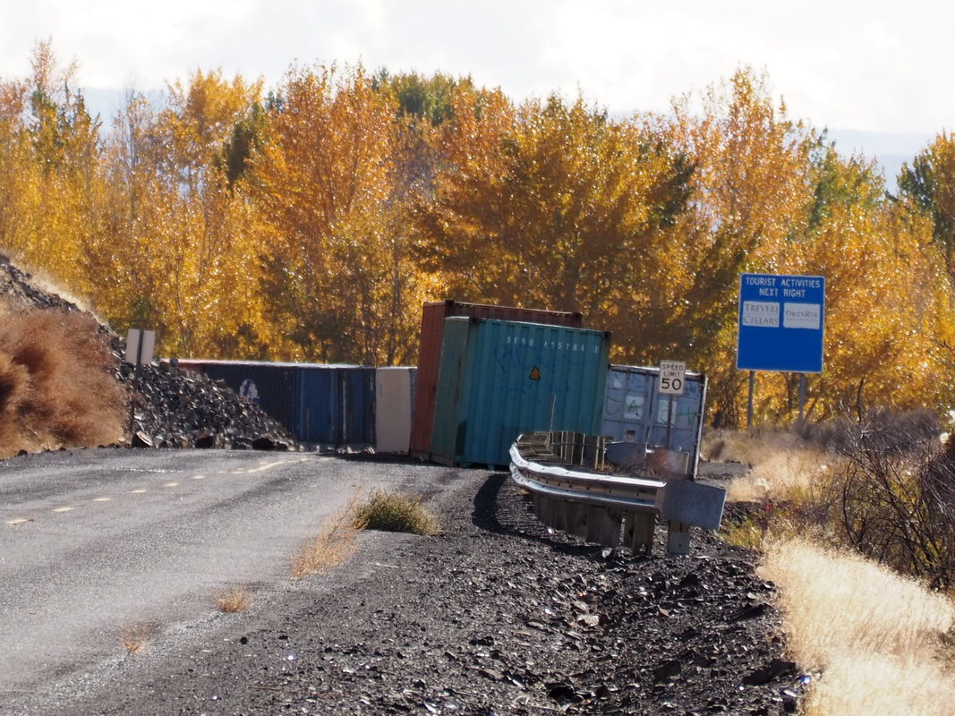
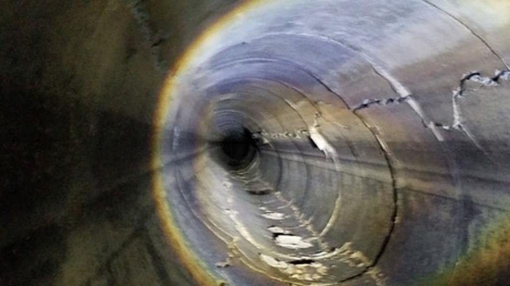
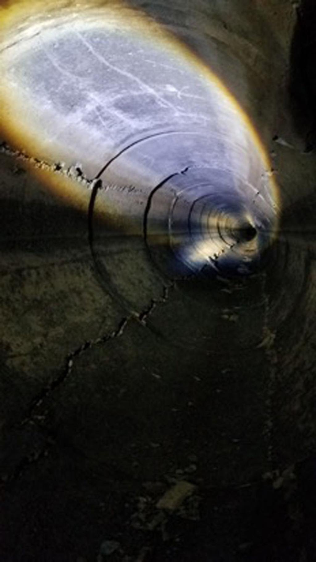
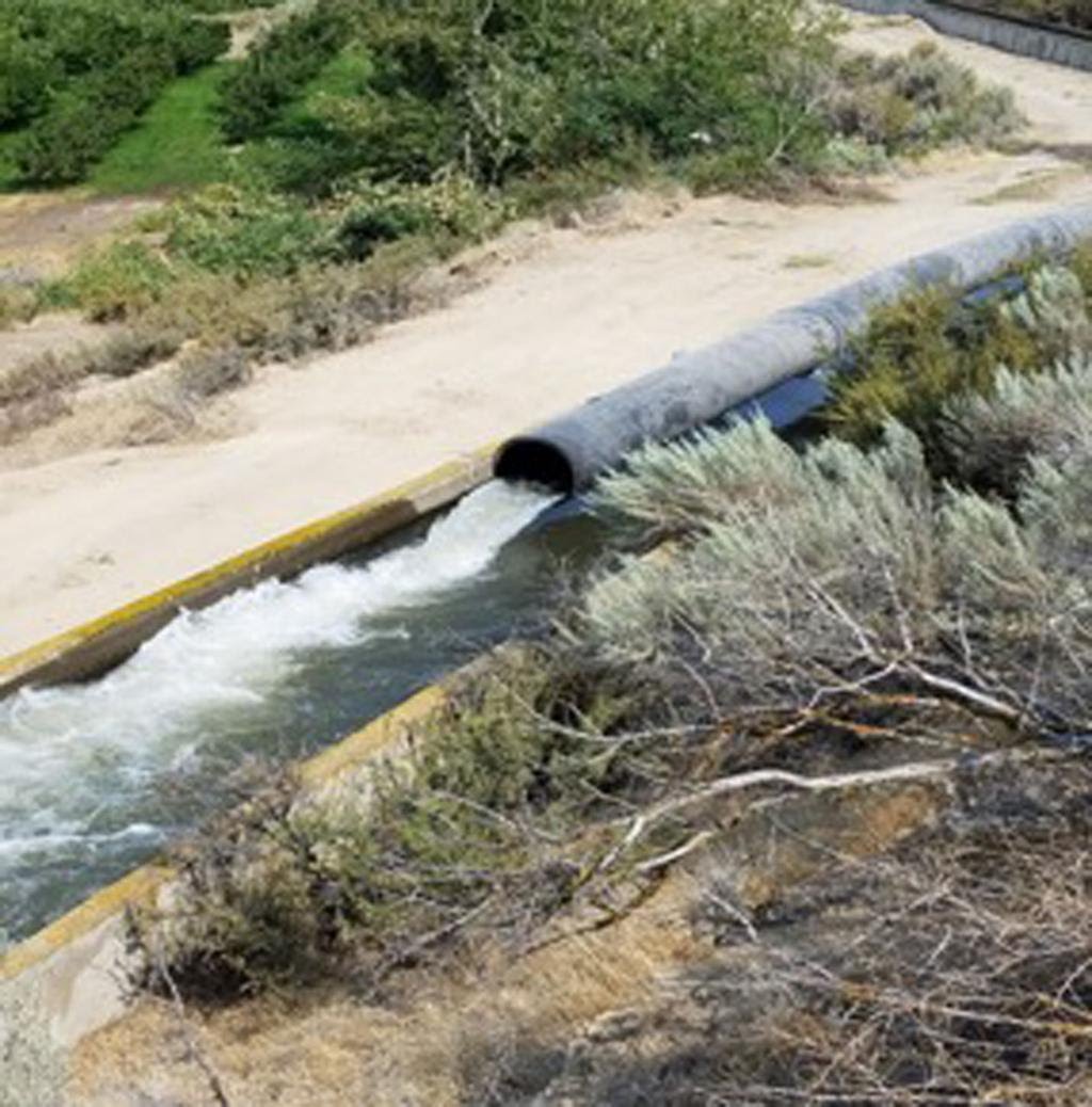
Irrigation Pipes Damaged
I just read a Yakima Herald article, click here. Union Gap irrigation is beyond repair, see images below. The article was published on November 15, 2018 and updated December 5, 2018. The Yakima Herald reports, "irrigates 3,222 acres of land between the gap and Cheyne Road, north of Zillah. It serves about 170 customers, said district manager Patrick Andreas". Alternate routes to provide irrigation to farmers would include working with Sunnyside Irrigation and Roza Irrigation to divert water to local farmers. They (Union Gap Irrigation) is uncertain if they can complete this task by March of 2019, by which farmers would start to need water for their crops. It is estimated "the annual crop value of the area at $40 million, and estimated that the land, orchard and vineyard value is between $40 million and $60 million". The cost of the new plan to provide electricity for the new pumps has not been provided. District officials report that the estimated the pipe was damaged sometime in the last year due to the estimated 8 million tons of rock and soil continued to move down the hill, just east of Union Gap.
Union Gap irrigation
December 25, 2018
February 6, 2019 Winter Storm
Screenshot of the UofOregon Live Cam
Feb 5, 2019
Feb 21, 2019
Feb 21, 2019